La Kerry Way

Viaggio Autoguidato lungo la Penisola di Kerry

Difficoltà
2
Distanza
191 km
durata
11 giorni | 10 notti
periodo
Mar Apr Mag Giu Lug Ago Set Ott
prezzo da
€ 1.434
Impronta CO2
126 Kg/persona
  1. Irlanda
  2.  | 
  3. Viaggi a Piedi
  4.  | 
  5. Codice del viaggio IRL02

The Kerry Way, stretching 230km, is the longest of Ireland's Waymarked Trails and is traditionally hiked in a clockwise direction, beginning and ending in Killarney.

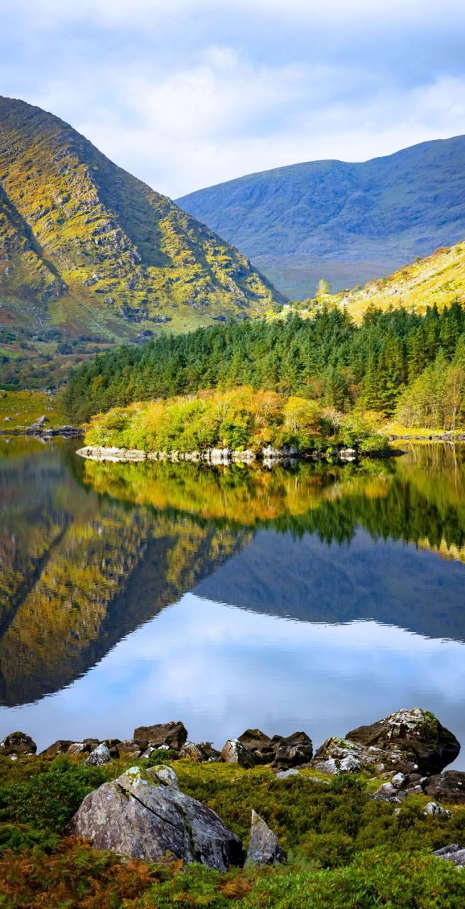
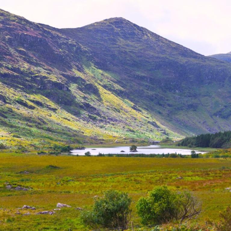
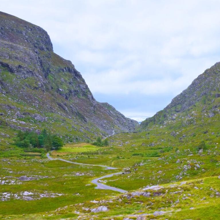
Divided into 9 stages, the route passes through charming Kerry towns like Glenbeigh, Caherciveen, Waterville, Sneem, and Kenmare. It skirts the base of the MacGillycuddy's Reeks, home to Ireland's two highest peaks, Carrauntoohil (1038m) and Caher (1001m), towering over the Black Valley. While avoiding these lofty summits, the trail weaves through quiet roads, open moorlands, woodlands, and field paths. Some isolated sections can be wet and muddy, with occasional steep climbs.

You can customize your journey by adding airport transfers, a night in Dublin, or a rest day; just let us know, and we’ll handle the arrangements!
 

Da non perdere

  • Admire varied and dramatic landscapes, from lush green valleys and forests to rugged coastlines and serene beaches;
  • Discover the beauty of Muckross House, a Victorian mansion surrounded by the scenic landscapes of Killarney National Park;
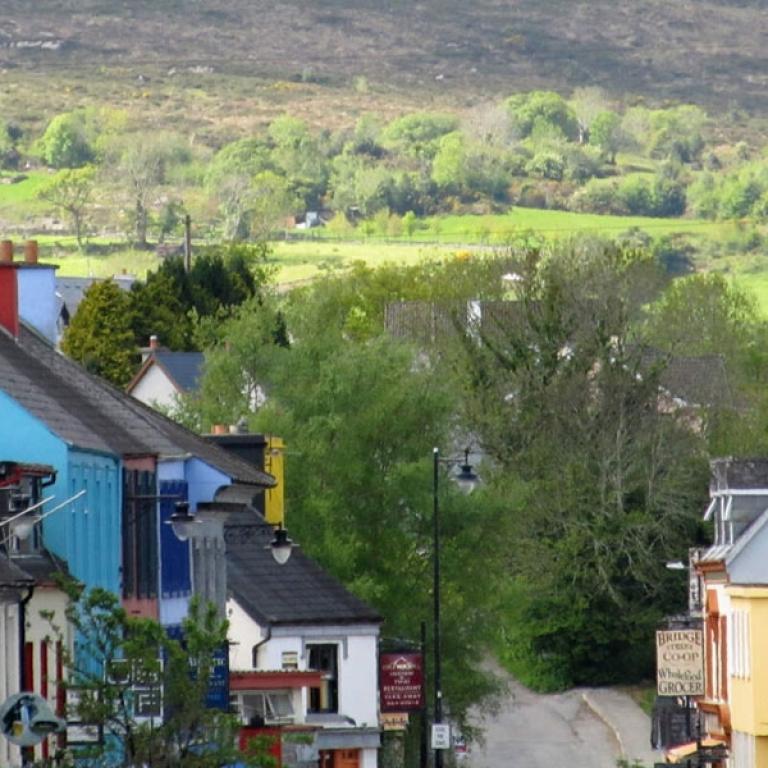
  • Sneem and its in local delights, like cheeses and sandwiches from its delis, making it a perfect stop to refuel before continuing your walk;
  • Explore Waterville, once a favorite holiday spot for Charlie Chaplin, and take a detour to visit the Skellig Islands, known for their ancient monastery and as the filming location for Star Wars: The Last Jedi;
  • Visit ancient landmarks like Staigue Fort, a well-preserved Iron Age ring fort, and witness historical farming practices;
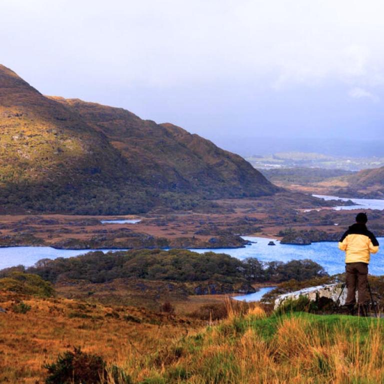
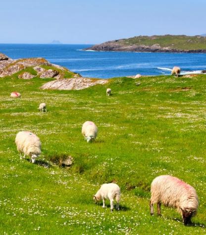
  • Take in panoramic views of Dingle Bay, Ballinskelligs Bay, and Kenmare Bay, with the sparkling Atlantic Ocean, lush green hills, and distant mountain ranges providing a constant visual treat throughout the trail.

Itinerario

Giorno 1

Arrivo a Killarney

Arrivo a Killarney

Killarney, one of Ireland's gems, is renowned for its stunning national park and breathtaking views. You can explore Killarney National Park, home to enchanting lakes, lush forests, and the famous Torc Waterfall. The town serves as a perfect starting point for venturing onto the Ring of Kerry, a scenic route that showcases spectacular landscapes. History enthusiasts can visit Muckross House and the ancient ruins of local monasteries, while outdoor lovers can enjoy hiking, horseback riding, and cycling tours. With its traditional pubs and vibrant cultural scene, Killarney offers an unforgettable experience for all its visitors.

Giorno 2

Da Killarney alla Black Valley, 22 km

Da Killarney alla Black Valley, 22 km

The Kerry Way officially begins at the Tourist Office in Killarney, leading south along the Muckross Road. The trail enters Bourn Vincent Memorial Park, offering stunning views across Lough Leane and the Shehy Mountains. A steep climb by Torc Waterfall brings you to the old Kenmare Road, a medieval path with mountains on either side. The route continues through Esknamucky Glen’s oak forests, eventually reaching Galway’s Bridge and Black Valley. Expect tranquil landscapes but prepare for steep climbs and some busy areas near popular sites like Lord Brandon’s Cottage.

Distanza: 22 km

Dislivello: +400 m

Giorno 3

Dalla Black Valley a Glencar, 20 km

Dalla Black Valley a Glencar, 20 km

Leaving the Black Valley, the Kerry Way ascends with stunning views over Bridia Valley. The trail alternates between quiet tarmac roads, gravel paths, and forest tracks, offering breathtaking views of the Caragh River Valley and Mulaghanattin Peak (773m). A surprise awaits at the Cooky Monster's Café in this remote area. Reaching the head of the pass, the panorama opens to Lough Acoose and Ireland's highest peak, Carrauntoohil (1,039m). The route then skirts Lough Acoose before connecting to the main road towards Glencar.

Distanza: 20 km

Dislivello: +500 m

Giorno 4

Da Glencar a Glenbeigh, 18 km

Da Glencar a Glenbeigh, 18 km

Starting from The Climbers Inn, the trail meanders through quiet country roads and forestry paths in the scenic Glencar Valley, offering beautiful views of the McGillycuddy Reeks, Seefin Mountain, and Lough Carragh. The route eventually reaches Gortdirragh. You'll face a climb to the Windy Gap, and you'll be rewarded with stunning vistas of Rossbeigh, Inch Strand, and the Dingle Peninsula. A rough descent follows, leading to a small road at Gowlane, with the final 2km of tarmac taking you into the heart of Glenbeigh.
 
Distanza: 18 km

Dislivello: +420 m

Giorno 5

Da Glenbeigh a Caherciveen, 28 km

Da Glenbeigh a Caherciveen, 28 km

This strenuous section is rewarded by the breathtaking view of Dingle Bay and Peninsula from the slopes of Drung Hill (640m). As you walk through woodlands and rural roads toward Cahersiveen, you'll pass historic field systems where locals once used seaweed to make arid land fertile. The remnants of this land reclamation, seen in stone fences and terraced fields, offer a glimpse into the area's agricultural past, once primarily used for potatoes and grazing.

Distanza: 28 km

Dislivello: +450 m

Giorno 6

Da Caherciveen a Waterville, 22 km

Da Caherciveen a Waterville, 22 km

From Teeraha, the Kerry Way trail ascends a ridge of small hills, gradually reaching peaks over 300 meters. The descent leads through minor roads to Mastergeehy and onward to Coomduff. At the summit of Coomduff, enjoy sweeping views: to the north, you’ll see Aghatubride, Foilclogh, and Beenduff, while the south-east is dominated by Coomcallee. To the southwest lies Lough Currane, framed by the mountains of Mullaghbeg, Cahernageeha, and Farraniaragh. Waterville and the Atlantic Ocean stretch out on the western horizon. The trail continues over rough terrain and Knag Hill, leading to the charming seaside village of Waterville.

Distanza: 22 km

Dislivello: +270 m

Giorno 7

Da Waterville a Caherdaniel, 13 km

Da Waterville a Caherdaniel, 13 km

Begin with a stroll past a statue of Charlie Chaplin, who was a frequent visitor to the area. After crossing the Currane River, the trail follows a quiet back road shared with the Ring of Kerry Cycle Route, offering views of Ballinskelligs Bay and the Skellig Islands. Along the way, you'll pass Loher Fort, an ancient stone structure from the 9th century, and fields that bear the remnants of the Great Famine of 1845. As the path turns, stunning views of Derrynane Bay and its islands open up. The last stretch takes you through Derrynane National Park's ancient forest, ending in the village of Caherdaniel.

Distanza: 13 km

Dislivello: +300 m

Giorno 8

Da Caherdaniel a Sneem, 19 km

Da Caherdaniel a Sneem, 19 km

Today you walk along "green roads," including part of the Old Kenmare Road, with stunning views over Kenmare Bay towards Bantry. A must-see is Staigue Fort, an impressive Iron Age ring fort with 4-meter-thick stone walls and an intriguing system of steps leading to the top. After passing a stone bridge, the route follows an old stagecoach road with elevated views of Staigue and Kenmare Bay. The final 2.5 km winds through forests, boreens, and quiet roads before arriving in the colorful village of Sneem.

Distanza: 19 km

Dislivello: +400 m

Giorno 9

Da Sneem a Kenmare, 23 km

Da Sneem a Kenmare, 23 km

This penultimate section is long but mostly flat, starting in Sneem and weaving through serene oak, birch, and holly woods around the Parknasilla estate. Passing the quiet village of Tahilla, the route offers stunning views of Coongar Harbour and Lough Fadda. Along the way, you'll encounter the traditional bamboo rushes used for thatching, now revived with flame-resistant treatments. The trail follows forest paths, roads, and mountain trails, crossing Blackwater Bridge with its picturesque surroundings, passing historical sites like Dromore Castle and Cappanacush Castle. As you near Templenoe, you’ll enjoy views of the Kenmare Estuary and the Caha Mountains on the Beara Peninsula. Two climbs over Lacka and Gortamullin Hills bring you to a peaceful gravel path leading into Kenmare's lively market square.

Distanza: 23 km

Dislivello: +520 m

Giorno 10

Da Kenmare a Killarney, 26 km

Da Kenmare a Killarney, 26 km

The final stage features a challenging ascent to the Windy Gap (320m) via Strickeen Hill. From the summit, hikers are rewarded with sweeping views of Killarney National Park and a ring of mountain peaks, including Eagles Nest and Purple Mountain. As the trail descends, it splits, offering a scenic route through oak forests and above the treeline, with the majestic MacGillycuddy Reeks visible to the northwest. Retracing earlier steps, the path leads through the tranquil Esknamucky Glen and Torc Waterfall before passing Muckross Estate. The final 2.5km brings walkers back to Killarney, completing the adventure beside Lough Leane and Muckross House.

Distanza: 26 km

Dislivello: +630 m

Giorno 11

Arrivederci, Kerry Way!

Arrivederci, Kerry Way!

I servizi terminano dopo al colazione se non ne avete prenotati altri. 

Dettagli

Cosa è incluso


La quota comprende

  • 10 pernottamenti in camera doppia in Pensione e B&B  con prima colazione;
  • Trasporto bagagli da albergo ad albergo
  • Descrizioni dettagliate del percorso in formato digitale, mappe, tracce GPS e App
  • Assicurazione medico-bagaglio
  • Supporto telefonico 24h su 24

La quota non comprende

  • Viaggio per raggiungere le località di arrivo e partenza
  • I pranzi e le cene, salvo dove diversamente indicato.
  • Le visite e gli ingressi - le mance
  • Gli extra di carattere personale
  • Eventuali tasse di soggiorno
  • Tutto quanto non specificato sotto la voce “la quota comprende”

Servizi aggiuntivi
Si possono richiedere oltre ai servizi compresi nella quota

  • Supplemento camera singola
  • Assicurazione annullamento
  • Giorni extra di riposo
  • Notti Extra a Dublino
  • Eventuali transfer per arrivare alla località di partenza o per ritornare dal punto di arrivo, che potranno essere quotati su richiesta


Sistemazione


Per i nostri viaggi scegliamo sempre strutture di accoglienza con camera private e bagno privato. In rari casi, casi sono previste sistemazioni condivise o con bagno in comune per questo ti consigliamo di controllare sempre con attenzione la sezione delle inclusioni per capire che tipologia di sistemazione è prevista all’interno del viaggio che ti interessa.

Diamo molta importanza alla scelta delle sistemazioni e scegliamo le strutture alberghiere con cura e attenzione. Sappiamo quanto sia importante riposare bene dopo una giornata di cammino. Preferiamo sempre strutture accoglienti e caratteristiche, preferibilmente a conduzione familiare, che rappresentino a pieno lo spirito del luogo e sappiano ospitarvi con cortesia e confort. 

Dove, per la natura del percorso, la scelta di strutture di accoglienza è limitata, scegliamo l’opzione che più si avvicina al nostro ideale. 

Cosa portare


Maglie e pantaloni
Vi consigliamo di indossare pantaloni e pantaloncini comodi e magliette traspiranti: asciugano rapidamente, non assorbono umidità e sono acquistabili in molti negozi. Vi consigliamo di portare un paio di pantaloni larghi a indossare la sera. I pantaloncini sono utili in giornate particolarmente calde e umide.

Scarpe
L’importanza di avere un buon paio di scarpe è primaria. Vi invitiamo ad indossare scarpe robuste e di buona qualità, in grado di affrontare le diverse tipologie di terreno. Leggeri, resistenti all’acqua, traspiranti e con una buona protezione per le caviglie. FONDAMENTALE aver usato fatto diverse camminate con le scarpe nuove, prima di iniziare il cammino. Invece se le scarpe sono molto usate/vecchie, controllare che non si stia per scollare la suola. 

Scarpe da tennis/sandali
Vi consigliamo di portare con voi un paio di scarpe da tennis o sandali di buona qualità, da indossare la sera e durante le pause in cammino.

Calze e intimo
Portate delle calze di buona qualità, traspiranti e che asciugano velocemente. Ricordate di testarle prima di portarle in viaggio, per valutarne la comodità con gli scarponi. Portate una quantità di intimo sufficiente: tenete presente che le lavanderie a gettoni non sono garantite in tutte le strutture.

Giacche a vento, cappello, guanti
Consigliamo di portare indumenti caldi specialmente per la sera, in primavera e in autunno. Assicuratevi che siano adatti alle vostre esigenze: una giacca a vento leggera va bene anche per le sere d’estate. Se camminate in montagna o sulla costa, il tempo è imprevedibile anche d’estate: dovete quindi essere preparati ad ogni condizione atmosferica: nebbia, neve, pioggia, grandine. Vi consigliamo di avere sempre a portata di mano un paio di guanti e un cappello. 

Giacche e pantaloni impermeabili
Se venite colti da una pioggia improvvisa e indossate il key-way, dovreste rimanere asciutti. Sfortunatamente non tutti sanno che questi capi impermeabili si deteriorano con il tempo, perdendo qualità ed efficacia. In media durano tra 3 e 5 anni. Vi consigliamo di portare key-way con il cappuccio e pantaloni impermeabili con le zip ai lati, facilmente indossabili anche con gli scarponi.

Restrizioni di abbigliamento
Quando entrate nelle chiese o in luoghi di culto dovete indossare un abbigliamento appropriato: in molti di questi luoghi non sono accettati pantaloncini e canottiere. Vi consigliamo di portare una un telo per coprirvi le spalle (utile anche per evitare le scottature).

Borraccia e/o sacca idrica
Quando fai sport è molto importante essere e rimanere idratati, soprattutto se fa caldo. Bisogna bere prima di partire e durante l’attività. Consigliamo molto la sacca idrica perché puoi continuare a bere usando la lunga cannuccia, senza doverti fermare tutte le volte e togliere lo zaino per prendere la borraccia. Questa s’infila dentro allo zaino, ingombra poco perché piatta ed è capiente portando fino a 2Lt.

Bastoncini da trekking
Vivamente consigliati. Possono aiutare, in quanto scaricano una parte del peso dalle spalle alle bacchette. E' stato valutato che è come avere uno zaino pesante il 30% in meno, che non è poco. Ma occorre fare un po' di pratica, dato che la camminata di un quadrupede (con le due gambe naturali e i due bastoncini) è ovviamente diversa da quella di un bipede. Se soffrite di mal di schiena o alle ginocchia oppure non avete un granché di equilibrio, aiutano. 

Informazioni pratiche

Come arrivare


Arrivo:
L'aeroporto più vicino si trova a Dublino.   
Dalla stazione ferroviaria di Dublino, prendere il bus locale per Killarney (spesso è previsto un cambio).

Partenza:
Da Killarney prendere l'autobus locale per Dublino (spesso è previsto un cambio).

La nostra App


Se viaggiate con uno smartphone o un tablet Apple o Android, potete scaricare gratuitamente la App di sloWays.

Nella sezione “itinerari” visualizzare il vostro itinerario e sarete in grado di localizzare costantemente la vostra posizione sulla mappa grazie alla tecnologia GPS. Maggiori informazioni su come utilizzare l'app sono contenute nei documenti del roadbook che vi verranno consegnati una volta prenotato il viaggio. 

Tra le funzioni della nostra App personalizzata: 

  • Navigazione offline; non è richiesta copertura internet dopo aver scaricato l'itinerario.
  • Accurata navigazione basata su tracce GPS
  • Autorotazione delle Mappe
  • Descrizione giornaliera dell'itinerario e tabella delle altitudini
  • Vista panoramica dell'itinerario e navigazione a livello strada
  • Allarme e vibrazione che ti avvisano se vai fuori strada
  • Opzione d'emergenza per inviarci la vostra posizione nel caso vi siate persi
  • Possibilità di segnalare un punto in particolare e fare foto georeferenziate per informarci di problemi particolari
    info sugli hotel 

Ti potrebbero anche piacere:


Wanderlust Nominee Best Specialist Tour Operator 2023
Wanderlust
Nominee Best Specialist Tour Operator 2023
Cambia la valuta:

I tuoi pagamenti online sono protetti.

Metodi di pagamento accettati:

VISA MASTERCARD MAESTRO SATISPAY

I tuoi pagamenti online sono protetti.

Metodi di pagamento accettati:

VISA
MASTERCARD
MAESTRO
SATISPAY
FTO ATTA member
100% Green Travelife
FTO ATTA member 100% Green Travelife

Organizzazione tecnica
S-Cape Countryside Travels srl
Borgo Allegri 16R
50122 Firenze FI
P. IVA 05227330486

© 2024 SloWays. All rights reserved.
Touroperator | S-Cape Countryside Travels srl | Borgo Allegri 16R 50122 Firenze FI, Italia
Partita IVA 05227330486
extraSmallDevice
smallDevice
mediumDevice
largeDevice
largeDevice
largeDevice