La Dingle Way

Viaggio Autoguidato lungo la Penisola di Dingle

Difficoltà
2
durata
10 giorni | 9 notti
periodo
Mar Apr Mag Giu Lug Ago Set Ott
prezzo da
€ 1.314
  1. Irlanda
  2.  | 
  3. Autoguidato
  4.  | 
  5. Codice del viaggio IRL01

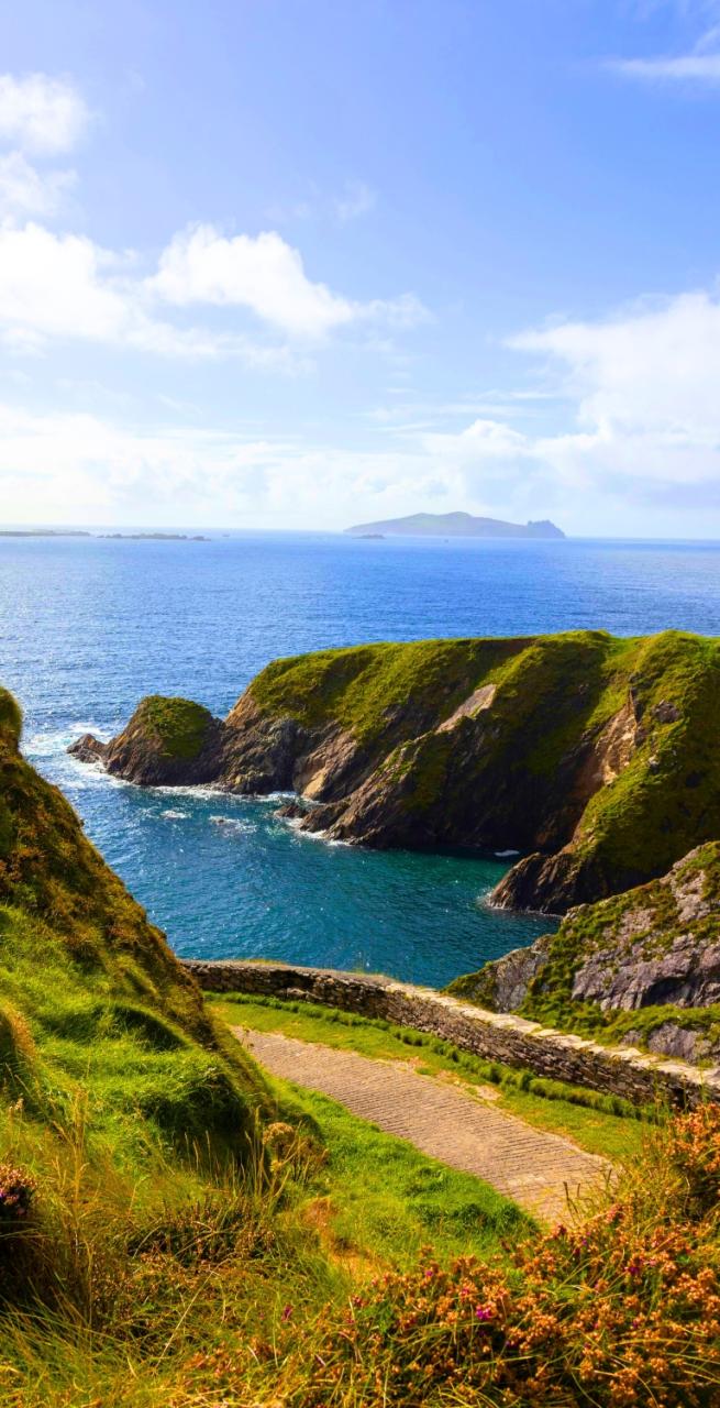
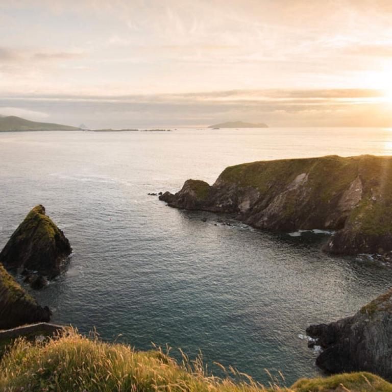
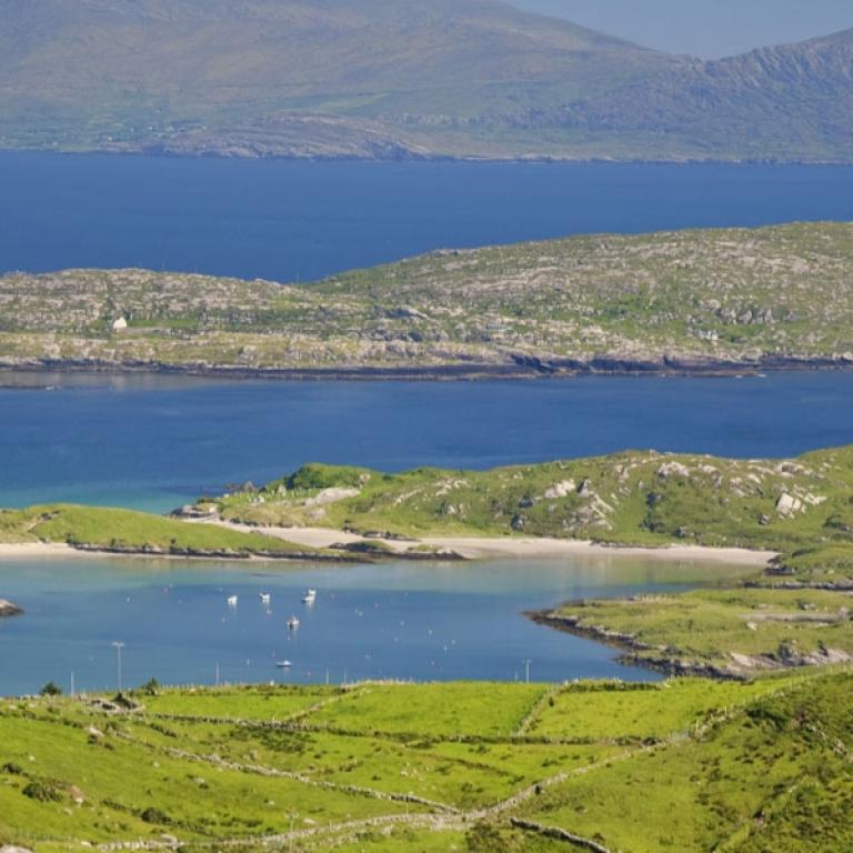
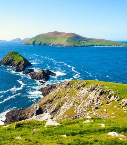
The ruggedly beautiful Dingle Peninsula, extending 50km into the Atlantic Ocean, is situated in the southwest of Ireland. Its isolation and remoteness have allowed the area’s rich cultural heritage and ancient archaeological treasures to be extremely well preserved. Voted among the Top 100 destinations in the world by TripAdvisor and referred to as  'the most beautiful place on earth'  by National Geographic, there may be more difficult trail marked routes in the world but few are more stunning. 

The Dingle Way is a circular route starting and finishing in Tralee, the capital of Kerry. The Dingle Way terrain consists mainly of quiet  roads, mountain, field and cliff paths with over 20km of good beach walking. Although there are some short steep  ascents, there are no significant climbs.

You can specify how many days you'll be walking when making your reservation.  You can add airport transfers, an overnight stay in Dublin, or a rest day along the way; simply let us know and we will gladly quote you a price and make the necessary arrangements. 

Da non perdere

  • Breathtaking views of glacial valleys, rugged cliffs, and the majestic Brandon Mountain, showcasing Ireland's natural beauty;
  • Historical sites such as Minard Castle and the Ogham Stone;
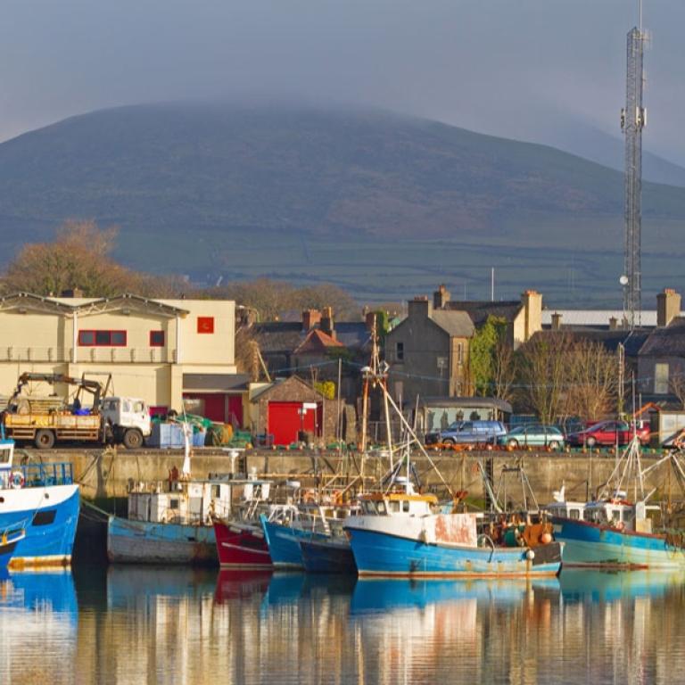
  • The vibrant town of Dingle serves as a hub for local culture, with colorful streets filled with artisan shops, traditional pubs, and the famous Dingle Oceanworld Aquarium;
  • Fermoyle Beach and other scenic stretches along the coast provide beautiful walking paths, perfect for enjoying the Atlantic views;
  • The chance to indulge in fresh seafood and traditional Irish dishes at local pubs enhances the experience, offering a taste of the region's culinary delights

Itinerario

Giorno 1

Arrivo a Tralee

Arrivo a Tralee

Upon arriving in Tralee you are greeted by the charming blend of traditional Irish culture and scenic beauty. Located in County Kerry, Tralee is the gateway to exploring the stunning landscapes of the Wild Atlantic Way. Visitors can start by strolling through the town's historic streets, visiting the Kerry County Museum, or enjoying a peaceful walk in the Tralee Town Park. Then indulge in local Irish cuisine, with fresh seafood, hearty stews, and traditional dishes like soda bread and black pudding served in the town's cozy pubs and restaurants.


Giorno 2

Da Tralee a Camp, 22 km

Da Tralee a Camp, 22 km

The Dingle Way is a scenic hiking trail that starts in Tralee, at the Kerry Museum, and leads through diverse landscapes towards Blennerville and beyond, eventually reaching the village of Camp. The route takes you along the canal, through quiet country roads, and up the Slieve Mish mountain range, offering stunning views of Mount Brandon and ancient glacial valleys. However, some sections, particularly the moorlands, can be marshy and challenging, so hikers should be prepared with proper gear like gaiters and extra socks. Highlights along the way include the Victorian reservoir, the ruins of Killelton Oratory, and the original Tralee to Dingle stone path.

Distanza: 22 km

Dislivello: +200m

Giorno 3

Da Camp a Annascaul, 17 km

Da Camp a Annascaul, 17 km

Today you walk along local roads, crossing the Finglas River and gradually emerging from the valley. The path offers stunning views of Caherconree Mountain (835m) and its ancient megalithic fort. Though the trail includes some rough and steep tracks, hikers are rewarded with sights like the Emlagh River and the famous Inch Beach, known for its golden sands and film history. As the route continues, it passes through forests and fields before descending into Annascaul village. Highlights include Lough Anscaul in a glacial valley and the South Pole Inn, once owned by Antarctic explorer Tom Crean.

Distanza: 17 km

Dislivello: +270 m

Giorno 4

Da Annascaul a Dingle, 19 km

Da Annascaul a Dingle, 19 km

Leaving Annascaul, the Dingle Way follows the busy Tralee-Dingle road before transitioning to a quieter road, eventually reaching the sea and the ruins of the 16th-century Minard Castle. The beach offers stunning views across to the Ring of Kerry. From there, the trail climbs a steep path and continues through farmland and traditional Kerry boreens. As the route approaches Lispole. The trail then ascends the lower slopes of Croaghskearda Mountain, where the terrain can become muddy. The path continues through farmland, crossing the Garfinny River, before leading to the famous Conor Pass, offering breathtaking views as the trail descends into the town of Dingle.

Distanza: 19 km

Dislivello: +220 m

Giorno 5

Giorno di Riposo a Dingle

Giorno di Riposo a Dingle

Today you can explore Dingle, a picturesque gem on Ireland's southwest coast. Immerse yourself in its vibrant culture and breathtaking scenery. Stroll through colorful streets lined with artisan shops, cozy cafés, and lively pubs where traditional music fills the air. Dive into the wonders of the sea at the Dingle Oceanworld Aquarium, home to the beloved resident dolphin, Fungie. Don’t miss the chance to savor mouthwatering fresh seafood—Dingle is a true culinary delight!

Giorno 6

Da Dingle a Dunquin, 20 km

Da Dingle a Dunquin, 20 km

As you leave Dingle on the Dingle Way, you'll pass historical sites like 1908 government housing and the Milltown River B&B, where Robert Mitchum stayed during Ryan’s Daughter. After crossing the Milltown River bridge, follow signposts through farmland towards Ventry Beach, a 2.5 km sandy stretch. The trail then skirts Mount Eagle, offering stunning views of the Blasket Islands and ancient beehive huts. Be cautious on the narrow tourist road leading to Dunquin Pier, where the route ends at the Blasket Islands Heritage Centre, rich with local history.

Distanza: 20 km

Dislivello: +370 m

Giorno 7

Da Dunquin a Bellydavid, 16 km

Da Dunquin a Bellydavid, 16 km

As you leave Dunquin, the Dingle Way takes you uphill, passing fields where seaweed was used to reclaim land for farming. You'll see patches of farmland created by clearing rocks and enriching the soil with sand and seaweed. The trail offers great examples of this on the hillside. The route turns into a gravel path at An Ghráig, then descends to rejoin the main road. Notable stops include Louis Mulcahy's pottery studio and Clogher Beach. Continuing along cliffs with stunning views of the Atlantic, the trail passes Dun an Oir, site of a 1580 massacre, before winding through Smerwick Harbour and reaching Ballydavid.

Distanza: 16 km

Dislivello: +1000 m

Giorno 8

Da Bellydavid a Cloughane, 19 km

Da Bellydavid a Cloughane, 19 km

Leaving Ballydavid, you walk through a scenic cliff walk before heading inland and rejoining the road at Glashabeg. As you pass through Feohanagh, the impressive Brandon Mountain rises ahead, with the cliffs of Ballydavid Head to the northwest blocking views of the sea. The trail then leads to a challenging climb between Masatiompan and Piaras Mor, where hikers will find an Ogham Stone boundary marker dating back to 500 AD. You'll arrive to the quiet village of Brandon, where two pubs by the seafront offer a perfect spot to relax. The final stretch of the trail takes you to Cloghane Village.

Distanza: 19 km

Dislivello: +670 m

Giorno 9

Da Cloughane a Castlegregory, 29 km

Da Cloughane a Castlegregory, 29 km

Depart from Cloghane along a quiet road that curves inland, offering impressive views of glacial valleys to the south. The route passes through Drom and Farrendalouge, eventually emerging at Fermoyle Beach. In contrast to the previous day’s mountain terrain, this stunning beach will be your path for much of the journey to Castlegregory. Watch for the Maharee Islands in Brandon Bay to your left and Fermoyle House. As you reach the top of the strand, the trail passes through the small village of Fahamore, where two welcoming pubs offer refreshments. The final stretch of tarmac road leads you to Castlegregory.

Distanza: 29 km

Dislivello: -50 m

Giorno 10

Arrivederci, Dingle Way!

Arrivederci, Dingle Way!

I servizi terminano dopo al colazione se non ne avete prenotati altri. 


Dettagli

Cosa è incluso


La quota comprende

  • 9 pernottamenti in camera doppia in Pensione e B&B  con prima colazione;
  • Trasporto bagagli da albergo ad albergo
  • Descrizioni dettagliate del percorso in formato digitale, mappe, tracce GPS e App
  • Assicurazione medico-bagaglio
  • Supporto telefonico 24h su 24

La quota non comprende

  • Viaggio per raggiungere le località di arrivo e partenza
  • I pranzi e le cene, salvo dove diversamente indicato.
  • Le visite e gli ingressi - le mance
  • Gli extra di carattere personale
  • Eventuali tasse di soggiorno
  • Tutto quanto non specificato sotto la voce “la quota comprende”

Servizi aggiuntivi
Si possono richiedere oltre ai servizi compresi nella quota

  • Supplemento camera singola
  • Assicurazione annullamento
  • Notti Extra a Dublino
  • Eventuali transfer per arrivare alla località di partenza o per ritornare dal punto di arrivo, che potranno essere quotati su richiesta

Sistemazione


Scegliamo le nostre sistemazioni con cura e attenzione, perchè sappiamo quanto sia importante riposare bene dopo una giornata di cammino. Scegliamo pensioni e bed and breakfast accoglienti e caratteristici a conduzione familiare, che rappresentano a pieno lo spirito del luogo e sappiano ospitarvi con cortesia e confort. Cerchiamo di vederli tutti, per conoscere di persona chi vi accoglierà. 

Cosa portare


Maglie e pantaloni
Vi consigliamo di indossare pantaloni e pantaloncini comodi e magliette traspiranti: asciugano rapidamente, non assorbono umidità e sono acquistabili in molti negozi. Vi consigliamo di portare un paio di pantaloni larghi a indossare la sera. I pantaloncini sono utili in giornate particolarmente calde e umide.

Scarpe
L’importanza di avere un buon paio di scarpe è primaria. Vi invitiamo ad indossare scarpe robuste e di buona qualità, in grado di affrontare le diverse tipologie di terreno. Leggeri, resistenti all’acqua, traspiranti e con una buona protezione per le caviglie. FONDAMENTALE aver usato fatto diverse camminate con le scarpe nuove, prima di iniziare il cammino. Invece se le scarpe sono molto usate/vecchie, controllare che non si stia per scollare la suola. 

Scarpe da tennis/sandali
Vi consigliamo di portare con voi un paio di scarpe da tennis o sandali di buona qualità, da indossare la sera e durante le pause in cammino.

Calze e intimo
Portate delle calze di buona qualità, traspiranti e che asciugano velocemente. Ricordate di testarle prima di portarle in viaggio, per valutarne la comodità con gli scarponi. Portate una quantità di intimo sufficiente: tenete presente che le lavanderie a gettoni non sono garantite in tutte le strutture.

Giacche a vento, cappello, guanti
Consigliamo di portare indumenti caldi specialmente per la sera, in primavera e in autunno. Assicuratevi che siano adatti alle vostre esigenze: una giacca a vento leggera va bene anche per le sere d’estate. Se camminate in montagna o sulla costa, il tempo è imprevedibile anche d’estate: dovete quindi essere preparati ad ogni condizione atmosferica: nebbia, neve, pioggia, grandine. Vi consigliamo di avere sempre a portata di mano un paio di guanti e un cappello. 

Giacche e pantaloni impermeabili
Se venite colti da una pioggia improvvisa e indossate il key-way, dovreste rimanere asciutti. Sfortunatamente non tutti sanno che questi capi impermeabili si deteriorano con il tempo, perdendo qualità ed efficacia. In media durano tra 3 e 5 anni. Vi consigliamo di portare key-way con il cappuccio e pantaloni impermeabili con le zip ai lati, facilmente indossabili anche con gli scarponi.

Restrizioni di abbigliamento
Quando entrate nelle chiese o in luoghi di culto dovete indossare un abbigliamento appropriato: in molti di questi luoghi non sono accettati pantaloncini e canottiere. Vi consigliamo di portare una un telo per coprirvi le spalle (utile anche per evitare le scottature).

Borraccia e/o sacca idrica
Quando fai sport è molto importante essere e rimanere idratati, soprattutto se fa caldo. Bisogna bere prima di partire e durante l’attività. Consigliamo molto la sacca idrica perché puoi continuare a bere usando la lunga cannuccia, senza doverti fermare tutte le volte e togliere lo zaino per prendere la borraccia. Questa s’infila dentro allo zaino, ingombra poco perché piatta ed è capiente portando fino a 2Lt.

Bastoncini da trekking
Vivamente consigliati. Possono aiutare, in quanto scaricano una parte del peso dalle spalle alle bacchette. E' stato valutato che è come avere uno zaino pesante il 30% in meno, che non è poco. Ma occorre fare un po' di pratica, dato che la camminata di un quadrupede (con le due gambe naturali e i due bastoncini) è ovviamente diversa da quella di un bipede. Se soffrite di mal di schiena o alle ginocchia oppure non avete un granché di equilibrio, aiutano. 

Informazioni pratiche

Come arrivare


Arrivo:
L'aeroporto più vicino si trova a Dublino.   
Dalla stazione ferroviaria di Dublino, prendere il treno per Tralee (spesso è previsto un cambio di treno).

Partenza:
Da Castelgregory prendere l'autobus locale per Tralee.
A Tralee prendere il treno per Dublino (spesso è previsto un cambio di treno).

La nostra App


Se viaggiate con uno smartphone o un tablet Apple o Android, potete scaricare gratuitamente la App di sloWays.

Nella sezione “itinerari” visualizzare il vostro itinerario e sarete in grado di localizzare costantemente la vostra posizione sulla mappa grazie alla tecnologia GPS. Maggiori informazioni su come utilizzare l'app sono contenute nei documenti del roadbook che vi verranno consegnati una volta prenotato il viaggio. 

Tra le funzioni della nostra App personalizzata: 

  • Navigazione offline; non è richiesta copertura internet dopo aver scaricato l'itinerario.
  • Accurata navigazione basata su tracce GPS
  • Autorotazione delle Mappe
  • Descrizione giornaliera dell'itinerario e tabella delle altitudini
  • Vista panoramica dell'itinerario e navigazione a livello strada
  • Allarme e vibrazione che ti avvisano se vai fuori strada
  • Opzione d'emergenza per inviarci la vostra posizione nel caso vi siate persi
  • Possibilità di segnalare un punto in particolare e fare foto georeferenziate per informarci di problemi particolari
    info sugli hotel 

Wanderlust Nominee Best Specialist Tour Operator 2023
Wanderlust
Nominee Best Specialist Tour Operator 2023
Cambia la valuta:

I tuoi pagamenti online sono protetti.

Metodi di pagamento accettati:

VISA MASTERCARD MAESTRO SATISPAY

I tuoi pagamenti online sono protetti.

Metodi di pagamento accettati:

VISA
MASTERCARD
MAESTRO
SATISPAY
FTO ATTA member
100% Green Travelife
FTO ATTA member 100% Green Travelife

Organizzazione tecnica
S-Cape Countryside Travels srl
Borgo Allegri 16R
50122 Firenze FI
P. IVA 05227330486

© 2024 SloWays. All rights reserved.
Touroperator | S-Cape Countryside Travels srl | Borgo Allegri 16R 50122 Firenze FI, Italia
Partita IVA 05227330486
extraSmallDevice
smallDevice
mediumDevice
largeDevice
largeDevice
largeDevice