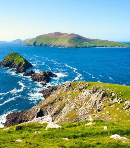
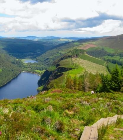
the dingle way coasts

The Dingle Way

Level
2
Duration
10 days | 9 nights
period
Mar Apr May Jun Jul Aug Sep Oct
price from
€ 1.314
  1. Ireland
  2.  | 
  3. Self-Guided
  4.  | 
  5. Tourcode IRL01

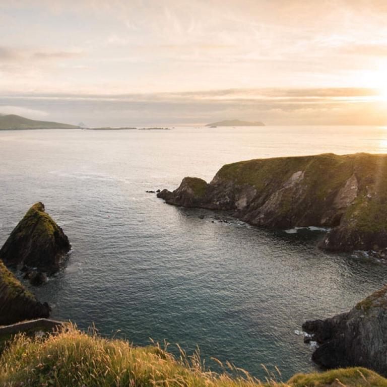
The ruggedly enchanting Dingle Peninsula stretches 50 kilometers into the Atlantic Ocean, a haven of untamed beauty in southwest Ireland. Its isolation has safeguarded a wealth of cultural heritage and ancient archaeological wonders, making it a timeless treasure. Ranked among the Top 100 destinations in the world by TripAdvisor and hailed as *"the most beautiful place on earth"* by National Geographic, the Dingle Peninsula offers trails that, while less challenging than others, are unparalleled in their breathtaking vistas.  

The Dingle Way is a circular journey that begins and ends in Tralee, the vibrant capital of Kerry. The route meanders through quiet country roads, rugged mountain paths, lush fields, and dramatic cliffside trails, with over 20 kilometers of pristine beach walking. While there are a few short, steep ascents, the trail is largely accessible, with no major climbs to deter adventurers.  

Customize your adventure to suit your pace and preferences. Choose how many days you'd like to walk, and consider adding extras like airport transfers, an overnight stay in Dublin, or a rest day along the way.

read more >>
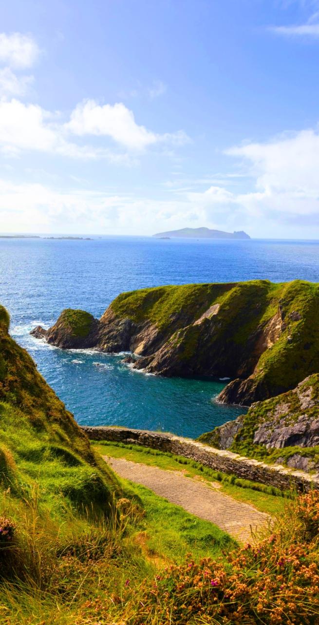
Highlights

  • Breathtaking views of glacial valleys, rugged cliffs, and the majestic Brandon Mountain, showcasing Ireland's natural beauty;
  • Historical sites such as Minard Castle and the Ogham Stone;
  • The vibrant town of Dingle serves as a hub for local culture, with colorful streets filled with artisan shops, traditional pubs, and the famous Dingle Oceanworld Aquarium;
  • Fermoyle Beach and other scenic stretches along the coast provide beautiful walking paths, perfect for enjoying the Atlantic views;
  • The chance to indulge in fresh seafood and traditional Irish dishes at local pubs enhances the experience, offering a taste of the region's culinary delights

Itinerary

Day 1

Arrive in Tralee

Arrive in Tralee

Upon arriving in Tralee you are greeted by the charming blend of traditional Irish culture and scenic beauty. Located in County Kerry, Tralee is the gateway to exploring the stunning landscapes of the Wild Atlantic Way. Visitors can start by strolling through the town's historic streets, visiting the Kerry County Museum, or enjoying a peaceful walk in the Tralee Town Park. Then indulge in local Irish cuisine, with fresh seafood, hearty stews, and traditional dishes like soda bread and black pudding served in the town's cozy pubs and restaurants.

Day 2

Tralee to Camp, 22 km

Tralee to Camp, 22 km

The Dingle Way is a scenic hiking trail that starts in Tralee, at the Kerry Museum, and leads through diverse landscapes towards Blennerville and beyond, eventually reaching the village of Camp. The route takes you along the canal, through quiet country roads, and up the Slieve Mish mountain range, offering stunning views of Mount Brandon and ancient glacial valleys. However, some sections, particularly the moorlands, can be marshy and challenging, so hikers should be prepared with proper gear like gaiters and extra socks. Highlights along the way include the Victorian reservoir, the ruins of Killelton Oratory, and the original Tralee to Dingle stone path.

Distance: 22 km

Elevation Gain: +200m

Day 3

Camp to Annascaul, 17 km

Camp to Annascaul, 17 km

Today you walk along local roads, crossing the Finglas River and gradually emerging from the valley. The path offers stunning views of Caherconree Mountain (835m) and its ancient megalithic fort. Though the trail includes some rough and steep tracks, hikers are rewarded with sights like the Emlagh River and the famous Inch Beach, known for its golden sands and film history. As the route continues, it passes through forests and fields before descending into Annascaul village. Highlights include Lough Anscaul in a glacial valley and the South Pole Inn, once owned by Antarctic explorer Tom Crean.

Distance: 17 km

Elevation Gain: +270 m

Day 4

Annascaul to Dingle, 19 km

Annascaul to Dingle, 19 km

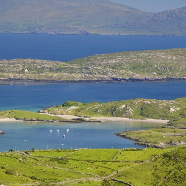
Leaving Annascaul, the Dingle Way follows the busy Tralee-Dingle road before transitioning to a quieter road, eventually reaching the sea and the ruins of the 16th-century Minard Castle. The beach offers stunning views across to the Ring of Kerry. From there, the trail climbs a steep path and continues through farmland and traditional Kerry boreens. As the route approaches Lispole. The trail then ascends the lower slopes of Croaghskearda Mountain, where the terrain can become muddy. The path continues through farmland, crossing the Garfinny River, before leading to the famous Conor Pass, offering breathtaking views as the trail descends into the town of Dingle.

Distance: 19 km

Elevation Gain: +220 m

Day 5

Rest day in Dingle

Rest day in Dingle

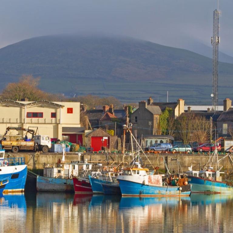
Today you can explore Dingle, a picturesque gem on Ireland's southwest coast. Immerse yourself in its vibrant culture and breathtaking scenery. Stroll through colorful streets lined with artisan shops, cozy cafés, and lively pubs where traditional music fills the air. Dive into the wonders of the sea at the Dingle Oceanworld Aquarium, home to the beloved resident dolphin, Fungie. Don’t miss the chance to savor mouthwatering fresh seafood—Dingle is a true culinary delight!

Day 6

Dingle to Dunquin, 20 km

Dingle to Dunquin, 20 km

As you leave Dingle on the Dingle Way, you'll pass historical sites like 1908 government housing and the Milltown River B&B, where Robert Mitchum stayed during Ryan’s Daughter. After crossing the Milltown River bridge, follow signposts through farmland towards Ventry Beach, a 2.5 km sandy stretch. The trail then skirts Mount Eagle, offering stunning views of the Blasket Islands and ancient beehive huts. Be cautious on the narrow tourist road leading to Dunquin Pier, where the route ends at the Blasket Islands Heritage Centre, rich with local history.

Distance: 20 km

Elevation Gain: +370 m

Day 7

Dunquin to Ballydavid, 16 km

Dunquin to Ballydavid, 16 km

As you leave Dunquin, the Dingle Way takes you uphill, passing fields where seaweed was used to reclaim land for farming. You'll see patches of farmland created by clearing rocks and enriching the soil with sand and seaweed. The trail offers great examples of this on the hillside. The route turns into a gravel path at An Ghráig, then descends to rejoin the main road. Notable stops include Louis Mulcahy's pottery studio and Clogher Beach. Continuing along cliffs with stunning views of the Atlantic, the trail passes Dun an Oir, site of a 1580 massacre, before winding through Smerwick Harbour and reaching Ballydavid.

Distance: 16 km

Elevation Gain: +1000 m

Day 8

Ballydavid to Cloughane, 19Km

Ballydavid to Cloughane, 19Km

Leaving Ballydavid, you walk through a scenic cliff walk before heading inland and rejoining the road at Glashabeg. As you pass through Feohanagh, the impressive Brandon Mountain rises ahead, with the cliffs of Ballydavid Head to the northwest blocking views of the sea. The trail then leads to a challenging climb between Masatiompan and Piaras Mor, where hikers will find an Ogham Stone boundary marker dating back to 500 AD. You'll arrive to the quiet village of Brandon, where two pubs by the seafront offer a perfect spot to relax. The final stretch of the trail takes you to Cloghane Village.

Distance: 19 km

Elevation Gain: +670 m

Day 9

Cloughane to Castlegregory, 29 km

Cloughane to Castlegregory, 29 km

Depart from Cloghane along a quiet road that curves inland, offering impressive views of glacial valleys to the south. The route passes through Drom and Farrendalouge, eventually emerging at Fermoyle Beach. In contrast to the previous day’s mountain terrain, this stunning beach will be your path for much of the journey to Castlegregory. Watch for the Maharee Islands in Brandon Bay to your left and Fermoyle House. As you reach the top of the strand, the trail passes through the small village of Fahamore, where two welcoming pubs offer refreshments. The final stretch of tarmac road leads you to Castlegregory.

Distance: 29 km

Elevation Gain: - 50 m

Day 10

Arrivederci, Dingle Way!

Arrivederci, Dingle Way!

Our services end after breakfast unless you have booked another service with us.


Details

Is this for me?


The Dingle Way is an ideal choice for those passionate about and drawn to Irish landscapes, enchanted by the variety of moorlands, cliffs, castles, villages, and many other quintessentially Irish features. However, before choosing this route, keep in mind that rain is almost guaranteed here—avoiding it might be a stroke of luck, but it’s definitely something to prepare for.

Another factor to consider is the difficulty of the trail—pay close attention to the daily elevations, but above all, be aware that several sections feature rugged terrain. Stability on your feet is essential, and some parts may be challenging for those who suffer from vertigo.

Included


What is included

  • 9 Nights in double room in Guesthouses and B&B with breakfast;
  • Luggage transportation from hotel to hotel (max 1 item per person);
  • Maps and detailed description of the itinerary in digital form, App;
  • Medical and luggage travel insurance;
  • 24h phone assistance.

What is not included 

  • Transfers to the starting location and from the arriving location of the tour;
  • Lunches and dinners, if not otherwise stated;
  • Visits and entrance fees - tips;
  • Personal expense;
  • Possible sojourn taxes;
  • Everything that is not mentioned in the "What is included" section.

Optional Services

These services can be added to the ones included in the base price of the tour:

  • Single room supplement;
  • Cancellation insurance;
  • Rest days along the way;
  • Extra nights in Dublin before and after you walk;
  • Transfers to reach the starting location or to leave the arriving location of the tour, which will be quoted on request.

Accommodation


Para nuestros viajes, siempre seleccionamos alojamientos con habitaciones privadas y baños privados. En casos excepcionales, pueden incluirse alojamientos compartidos o baños compartidos, por lo que recomendamos revisar cuidadosamente la sección de inclusiones para comprender el tipo de alojamiento proporcionado en el viaje que le interese.

Damos gran importancia a la elección de los alojamientos y seleccionamos los hoteles con cuidado y atención. Sabemos lo esencial que es descansar bien después de un día de caminata. Preferimos alojamientos acogedores y con encanto, idealmente de gestión familiar, que realmente reflejen el espíritu del lugar y puedan recibirte con comodidad y calidez.

Cuando, debido a la naturaleza del recorrido, la elección de alojamientos es limitada, seleccionamos la opción que mejor se ajuste a nuestros estándares.

When to travel


We recommend hiking the Dingle Way between March and October, when the weather and temperatures are milder. However, keep in mind that this is a very rainy destination, so don’t forget to pack reliable rain gear! Summer months are the safest in terms of weather but also the busiest. Additionally, be aware of mosquitoes, which are present from April to September!


What to bring


Clothing and other items
You will need your regular walking/cycling gear, including some sort of reflective garment. For the evenings, smart outdoor style trousers (or shorts) are invaluable, as are quick-dry t-shirts. These can be washed easily and will dry overnight and still look good for sightseeing or having a drink in town.

Take as little as possible to avoid potentially lugging a heavy suitcase up three flights of stairs at the end of the day. Please be aware that laundromats (“Laverie”) are not common in rural areas, so plan to do handwashing of small items.

Lightweight walking shoes/ trainers
For wearing around towns & villages. They can also be a back-up pair.

Socks & underwear
Take only good quality socks with quick-dry and insulating qualities. Road test them before you go on the trip. Take a suitable quantity of underwear as washing facilities are limited.

Warm jacket, hat, gloves
Bring a fleece, Polartec or warm layers for the evenings especially in spring or autumn; be sure it is totally suitable for your needs.
A fleece jacket which blocks the wind (Wind-stopper) is the most preferable. In the summer months a lightweight jacket is suitable for evenings.
If you are cycling/walking in mountainous or coastal areas, even in the height of summer, the weather can change very quickly and unexpectedly and you should be prepared for fog, mist, rain, snow or hail at any time. Always take an extra layer with you, as well as a warm hat and gloves.

Waterproof jacket & trousers
If you are caught in heavy rain, with good waterproof clothing you should remain dry. Remember that most garments will lose their properties over time. Few will remain waterproof for more than five years and many deteriorate in three years or less. We recommend a rain jacket with a good hood and collar and waterproof or thermal walking/cycling trousers or tights.

Dress code
In general, you should wear suitable clothing when entering a church (in many places, it is considered unacceptable to go inside wearing shorts or a tank-top). We suggest that women carry a shawl to cover up bear shoulders or low-cut tops. It also comes in handy when your shoulders get sunburned!

It is considered inappropriate for men to go without a shirt / T-shirt (other than at the beach).

Trekking poles (adjustable)
Highly recommended. A pair works best, depending on what you are comfortable with. If you suffer from back or knee pain this should be considered essential. Remember to practise walking with your pole(s) on different types of terrain in the months preceding your trip.

Walking boots
The importance of good footwear cannot be stressed enough. Your boots should be sturdy and of good enough quality to handle all types of terrain. Lightweight boots, (cordura/leather boots) which have Gore-Tex or sympatex water-proofing are most suitable for this trip. They should provide good ankle protection and be well broken in. Waxing leather boots regularly prolongs their life.

Walking tops & trousers
We recommend walking trousers and shorts and quick-dry wicking t-shirts. These can be washed easily and will dry overnight and still look good for sightseeing or having a drink in town. Wicking T-shirts are fast drying, keep moisture away from your skin and are available at outdoor stores. You should also bring one pair of loose-fitting trousers to wear in cities and for evenings out, etc. Shorts or zip-off trousers are useful in warmer weather.

Practical info

How to arrive


On Arrival:    
The closest airport to get to Tralee is in Dublin.
In Dublin take a train to reach Tralee (sometimes you have to change).

On Departure:
From Castelgregory take the local bus to Tralee.
In Tralee take the train to Dublin (sometimes you have to change).

Mobile App


Use the SloWays APP for iOS and Android smart phones in combination with the written documentation provided.

The App has the detailed tracks and maps that you can use offline and without roaming. Thanks to the phone’s internal GPS, you can check your exact position on the map, so you always know exactly where you are. It also helps you self-navigate you way while travelling. More information on how to use the App inside the roadbook documents.

The navigation features include:

  • Offline navigation. Mobile data not required after initial download
  • Accurate GPS tracks
  • Autorotation of the maps
  • Daily route summary and elevation chart
  • Panorama of the track and at street level
  • Alarm and vibration that alerts you in case you go off track.
  • Emergency SMS button with position coordinates
  • Possibility to record and take georeferenced photos of problems on route alerting fellow travelers
  • Hotel information
  • Points of interest along the way
  • Historical background

You may also like:


Wanderlust Nominee Best Specialist Tour Operator 2023
Wanderlust
Nominee Best Specialist Tour Operator 2023
Change currency:

We accept:

VISA MASTERCARD

We accept:

VISA
MASTERCARD
FTO ATTA member
100% Green Travelife
ISO Partner
FTO ATTA member 100% Green Travelife ISO Partner

Touroperating
S-Cape Countryside Travels srl
Borgo Allegri 16R
50122 Firenze FI
P. IVA 05227330486

 
© 2025 SloWays. All rights reserved.
Touroperating S-Cape Countryside Travels srl Borgo Allegri 16R 50122 Firenze FI, Italy
VAT Nr 05227330486
extraSmallDevice
smallDevice
mediumDevice
largeDevice
largeDevice
largeDevice