Albania Alps header mountains Valbona hiking

Albanian Alps Explorer

Level
3
Distance
61 km
Duration
8 days | 7 nights
period
Apr May Jun Jul Aug Sep Oct
price from
€ 900
CO2 footprint
238 Kg/person
  1. Albania
  2.  | 
  3. Hiking Tours
  4.  | 
  5. Tourcode ALSWALP

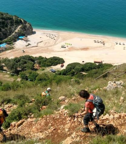
The Albanian Alps are slowly becoming the Balkans’ most fabled walking destination, and this tour includes all their highlights. Start your trip from the lively city of Shkodra, journey by bus through the Drin Canyons and boat across the fjord-like Komani Lake. Hike among the craggy, limestone mountains of Valbona, a place not unlike the Dolomites 70 years ago. Marvel at the highest peaks of the Accursed Mountains, crossing from one National Park into the other. Learn about the ancient highland codex of the Kanun, materialized in Theth's Blood Feud Tower, then visit the idyllic hamlet Nderlysaj and dive in the icy waters of the colorful oasis, the Blue Eye, before enjoying a night out in the capital, Tirana.
Highlights

Itinerary

Day 1

Welcome to Albania!

Welcome to Albania!

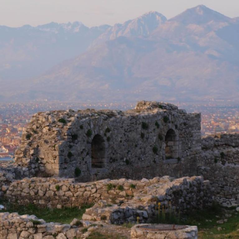
Welcome to the Balkans! We pick you up from Tirana or Podgorica (airport/city) for the two-hour transfer to Shkodra. Here you receive your materials (road book, maps, phone, GPS), a walk-through of the tour and have all remaining questions answered. Afterwards, the city calls for a stroll through the pedestrian area lined with bourgeoisie townhouses, a reminder of the city's prestigious past. Immerse yourself in the city’s Italian flair, join the buzz of the bazaar to buy dried fruits and other snacks, or dive into the past captured on film at the Marubi photo library. It's only a short taxi ride to visit the Rozafa Castle and enjoy the fabulous views, a foretaste for the upcoming days of travel through the Albanian Alps. With more time at hand, you can rent a bicycle (€5/day) and visit the lake-side villages of Shiroke and Zogaj for a fish meal and a splash in the Balkan's largest lake. The more relaxed will enjoy an espresso with the locals or visit the artisan shops before the daylight fades. Choose one of the many restaurants for dinner and get a drink at a bar, all while having tomorrow's early start in mind. You can store luggage at the hotel and collect it before travelling to Tirana.

Day 2

From Shkoder to Valbone, 7 km

From Shkoder to Valbone, 7 km

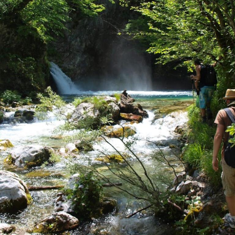
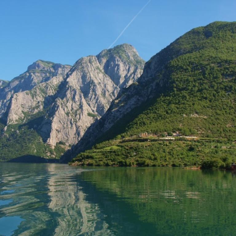
An early start is followed by a scenic drive through the Drin Gorges to the Komani Lake (58km/2h). The picturesque reservoir loops similar to a Norwegian fjord through sheer rock walls and is the most attractive route into the Albanian Alps. You're in for a surprise by the peculiar ferry, which stops several times to pick up talkative locals from remote villages before arriving at Fierze (46 km/3h). By car you continue further into the highlands of the Valbona National Park, stopping for a light lunch in the small-city Bajram Curri. In the early afternoon, you reach the Valbona Valley and it’s tower-houses made of stone. The warm-up walk follows a crystal clear stream through ancient beech forests, speckled with the sweetest wild strawberries. Along the way, the brave will stop for a swimming break at the ice-cold river or a secluded pond. The jagged peaks towering high above you give itchy feet for tomorrow's trek into the highlands. Tonight, you enjoy a delicious, hearty dinner and a well-earned rest after this impression-packed introduction to the Accursed Mountains.

Distance: 7 km

Altitude difference: +250 / +250 m

Day 3

Heights of Valbona – queen of the mountains

Heights of Valbona – queen of the mountains

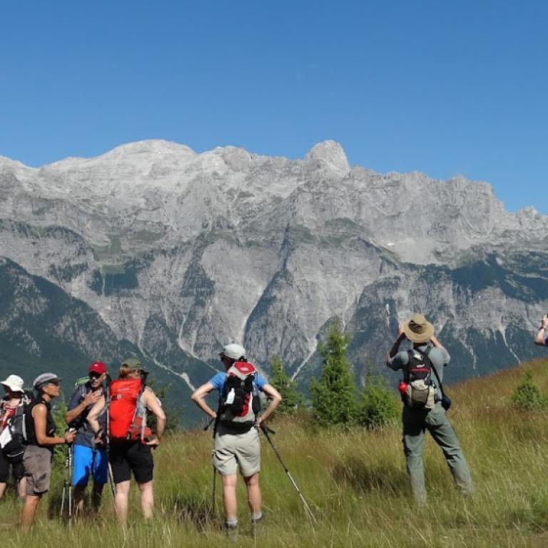
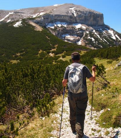
After a short transfer to the trailhead, you start the hike to Kukaj, an isolated hamlet where only two families reside. Below, bunkers that once protected the border are now scattered in the riverbed. The winding path takes you over lush meadows ablaze with the colors of a wide variety of spring flowers and through light beech forest up to a shepherd’s hut, on 1.650 m. In the communist period, when this was a no-go area, the building used to be a military barrack. Admire the wild and romantic jagged mountain scenery, enjoy a refreshing soda or opt to climb higher to an ancient crossing at the Montenegrin border. At 2.045 m, a weathered border pyramid is the only reminder of the isolation Albania once endured; from here views reach to the most dramatic parts of Montenegrin Prokletije. Catching a last glimpse at the Alps highest peak Jezerca (2.694 m), you descend first to Kukaj and then to your accommodation. When daylight fades, you admire the alpine glow over dinner in the idyllic veranda. No surprise many local women are named after the beautiful valley.

Distance: 9 km
Altitude difference: +625m/-625m

Distance: 12 km
Altitude difference: +700m/-750m

Distance: 17,5 km
Altitude difference: +1125m/-1125m

Day 4

From Valbone to Theth, 10 km

From Valbone to Theth, 10 km

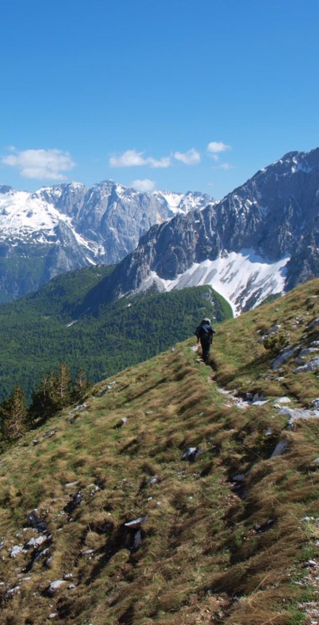
Another highlight, an important milestone in most Albanian Alps journeys, awaits today. After a short ride over the rough riverbed, you meet the mule porter who carries the main luggage and sets out for the hike across Valbona Pass (1.811 m). Above the village Rragam, a few steep segments need to be tackled. Pause regularly near springs and on colorful meadows to take a breath of herb-filled aromatic mountain air and enjoy the splendid views. Reaching the pass, the surrounding peaks appear on par and sweeping views of both national parks fascinate even the seasoned traveler. Enjoy the picturesque landscape during a lunch break ahead of the descent to Theth, where the fairy-tale beech forest provides cover from the afternoon sun. Close to the village, the woods thin out, Mt. Arapi (2.217 m) becomes more dominant and soon, you reach the uppermost houses of Gjelaj, Theth. Spread below are the valley's many hamlets, and a broad path takes you through the village to another inviting guesthouse.

Distance: 10 km

Altitude difference: +750 / -1125 m

Day 5

The Peja Pass or a meadow above the clouds

The Peja Pass or a meadow above the clouds

Choose today's hike between the route to the Peja Pass at the northern end of the valley, below the Matterhorn of Albania, or the panoramic trail to the high-up Meadows of Denelli. Both are return routes, and you stay for a second night at the same guesthouse. The first is sun-exposed, an early start is recommended. The trailhead is a 4 km drive/1 hour walking time each way away. Start at the source of the Thethi River, up the wall that still looks impenetrable. The ancient caravan path is hidden in the sheer 900 m drop below Mt. Arapi (2.217 m) and named after the Kosovo city Peja, where the route is connected.  The Denelli walk starts from the iconic Theth church, leads through the lush green Ulaj neighborhood and ascends, after a river crossing, into a light forest to a path in the cliffs & up to a large, high-up meadow in the middle of the mountains.

Distance: 7,5 km
Altitude difference: +650 / -650 m

Distance: 7,5 km
Altitude difference: +950/ -950 m

Distance: 9,5 km
Altitude difference: +1000 / -1000 m

Day 6

From Theth to Nderlysa, 8 km

From Theth to Nderlysa, 8 km

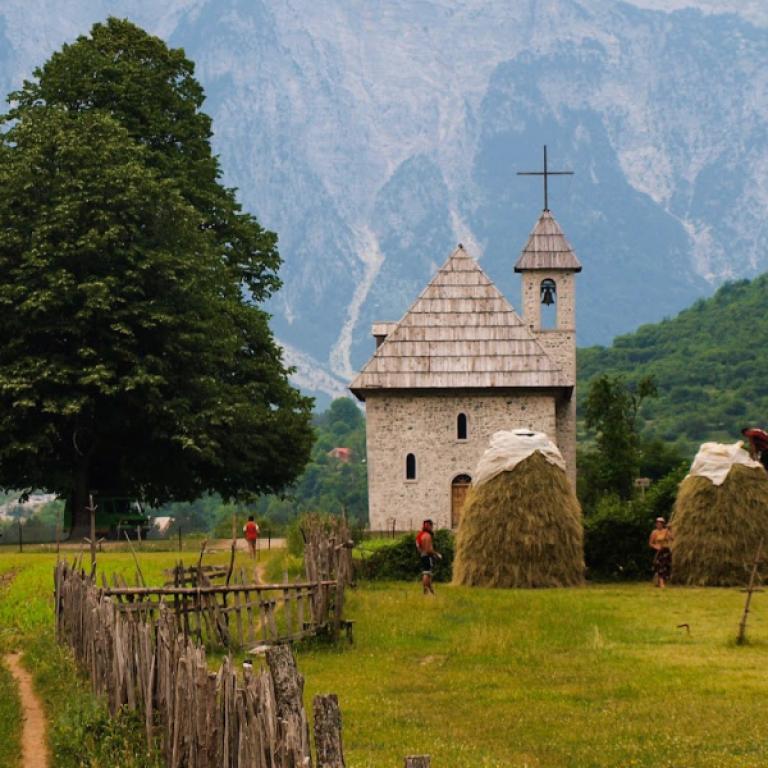
A walk through the village and it’s lush green fields reveals the full extent of Theth. Visit the iconic church and dive into the history of the “Kanun” at the nearby lock-in tower that offered protection to those affected by the Blood Feud. It is the perfect place to learn about the former highland law code of Leke Dukagjini, its origins and impact. Onward along water channels, the path ascends to the Grunas waterfall and drops to a cliff above the river, where archeologists discovered stone aged terraces. Gaze into the 50 m deep Grunas Canyon, before starting the second part of the hike on a well-worn bridle path that leads along the river downstream to Nderlysa, where a light lunch awaits at the beautiful garden of the hosts. Tonight's accommodation is a simpler, but very welcoming guesthouse in a calmer hamlet. Use your free time to sample mulberries, grapes and plums in the garden, ask your host about beekeeping or swim in the nearby glacier-formed stone pools. 

Distance: 8 km

Altitude difference: +150 / -400 m

Day 7

From Nderlysa to Tirana, 9 km

From Nderlysa to Tirana, 9 km

The hike through a canyon leads to a karst spring called the “Blue Eye”. The bravest can take a dip in the icy, butterfly surrounded waters - truly a hidden oasis to relax at. The walk can be extended to the close-by, abandoned hamlet of Kapreja. The transfer starts from the accommodation at around 1-2 pm, and it takes you on a scenic drive across the Thorja Pass into the Valley of Boge and along Lake Shkodra (2 h). In Shkodra, our driver meets you for another 2.5 hour transfer to arrive at the central hotel in Tirana. The capital city represents the modern, very different side of Albania. Conclude your day with a nice dinner and a drink out in the chic "Blloku" district, recall the past week of travel and celebrate the memorable journey through the Albanian Alps.

Distance: 9 km

Altitude difference: + 275 / -275 m

Day 8

Farewell Albania!

Farewell Albania!

Time permitting, Tirana invites you to explore its streets and sights on a stroll. Sip an espresso in one of the charming bars, observe the busy morning flow and select special treats as edible souvenirs at the lively “New Bazaar”. Interested to learn more about the communist past? “Bunkart 2” and “The House of Leaves” provide insights and are only a 5 min walk away from Tirana’s main "Skanderbeg Square". Your multi-faceted journey in Albania ends with a 40 min transfer to the airport. Thank you for joining our adventure, we hope to see you again in the country of warm hospitality, countless mountains and sun-kissed beaches. 

Details

Is this for me?


Hiking routes in the Albanian Alps are often narrow and uneven, sometimes they're also steep and rocky. Because the marking is not on par with the quality of the Central Europeans Alps, we provide a backup GPS unit to resolve unclear situations. While trails are in frequent use, there's no regular trail maintenance. While all trails are wide enough to be used by pack horses loaded with luggage and pose no objective danger, there's a 200 m stretch on the Valbona Pass (D4) and some minor and very short 5m stretches (D2 and D6, D7) that people suffering from vertigo my perceive as subjectively "intimidating". 

Included


What is included

  • 7 Nights in double room in ** hotels/guesthouses with breakfast
  • 6 lunches
  • 5 dinners
  • luggage transportation from hotel to hotel - max 15 kg, only duffelbags or backpacks
  • transfers as described in the day by day program, including the airport transfer
  • maps and detailed description of the itinerary in digital form, app
  • Medical and luggage travel insurance
  • 24h phone assistance

What is not included 

  • Transfers to the starting location and from the arriving location of the tour
  • lunches and dinners, if not otherwise stated
  • visits and entrance fees - tips
  • personal expense
  • possible sojourn taxes
  • everything that is not mentioned in the "What is included" section.

Optional Services

These services can be added to the ones included in the base price of the tour:

  • Single room supplement
  • cancellation insurance

Accommodation


We carefully select our accommodations because we know how important it is to rest well after a day of walking. We choose friendly and family run guest Houses, and bed and breakfasts that fully represent the spirit of the place and offer warm hospitality and comfort. Whenever possible, we visit them personally, so we can get to know the people who will be welcoming you.

Tradita - Shkoder

 +355 68 62 63 770 

www.traditagt.com

Pashko - Theth
Prel Bjeshka - Nderlysa
Vila 60 - Tirana

+355 69 558 1022 

www.vila60.com

When to travel


Summer sees stable mountain weather with daytime temperatures of 20-27°C. The occasional torrential thunderstorm rarely lasts more than 30-45 min. Before the first week of June you may encounter snow. When autumn colors start in late September and throughout October, rain and fog become more likely, daylight hours shorten and nighttime temperatures drop. Prepare for lowland heat in Shkodra and Tirana, especially in July and August.

What to bring


Clothing and other items
You will need your regular walking/cycling gear, including some sort of reflective garment. For the evenings, smart outdoor style trousers (or shorts) are invaluable, as are quick-dry t-shirts. These can be washed easily and will dry overnight and still look good for sightseeing or having a drink in town.

Take as little as possible to avoid potentially lugging a heavy suitcase up three flights of stairs at the end of the day. Please be aware that laundromats (“Laverie”) are not common in rural areas, so plan to do handwashing of small items.

Lightweight walking shoes/ trainers
For wearing around towns & villages. They can also be a back-up pair.

Socks & underwear
Take only good quality socks with quick-dry and insulating qualities. Road test them before you go on the trip. Take a suitable quantity of underwear as washing facilities are limited.

Warm jacket, hat, gloves
Bring a fleece, Polartec or warm layers for the evenings especially in spring or autumn; be sure it is totally suitable for your needs.
A fleece jacket which blocks the wind (Wind-stopper) is the most preferable. In the summer months a lightweight jacket is suitable for evenings.
If you are cycling/walking in mountainous or coastal areas, even in the height of summer, the weather can change very quickly and unexpectedly and you should be prepared for fog, mist, rain, snow or hail at any time. Always take an extra layer with you, as well as a warm hat and gloves.

Waterproof jacket & trousers
If you are caught in heavy rain, with good waterproof clothing you should remain dry. Remember that most garments will lose their properties over time. Few will remain waterproof for more than five years and many deteriorate in three years or less. We recommend a rain jacket with a good hood and collar and waterproof or thermal walking/cycling trousers or tights.

Dress code
In general, you should wear suitable clothing when entering a church (in many places, it is considered unacceptable to go inside wearing shorts or a tank-top). We suggest that women carry a shawl to cover up bear shoulders or low-cut tops. It also comes in handy when your shoulders get sunburned!

It is considered inappropriate for men to go without a shirt / T-shirt (other than at the beach).

Trekking poles (adjustable)
Highly recommended. A pair works best, depending on what you are comfortable with. If you suffer from back or knee pain this should be considered essential. Remember to practise walking with your pole(s) on different types of terrain in the months preceding your trip.

Walking boots
The importance of good footwear cannot be stressed enough. Your boots should be sturdy and of good enough quality to handle all types of terrain. Lightweight boots, (cordura/leather boots) which have Gore-Tex or sympatex water-proofing are most suitable for this trip. They should provide good ankle protection and be well broken in. Waxing leather boots regularly prolongs their life.

Walking tops & trousers
We recommend walking trousers and shorts and quick-dry wicking t-shirts. These can be washed easily and will dry overnight and still look good for sightseeing or having a drink in town. Wicking T-shirts are fast drying, keep moisture away from your skin and are available at outdoor stores. You should also bring one pair of loose-fitting trousers to wear in cities and for evenings out, etc. Shorts or zip-off trousers are useful in warmer weather.

Practical info

How to arrive


Airport to fly into and from is Tirana. The airport transfer to the first accommodation is included in the price.

Mobile App


Use the SloWays APP for iOS and Android smart phones in combination with the written documentation provided.

The App has the detailed tracks and maps that you can use offline and without roaming. Thanks to the phone’s internal GPS, you can check your exact position on the map, so you always know exactly where you are. It also helps you self-navigate you way while travelling. More information on how to use the App inside the roadbook documents.

The navigation features include:

  • Offline navigation. Mobile data not required after initial download
  • Accurate GPS tracks
  • Autorotation of the maps
  • Daily route summary and elevation chart
  • Panorama of the track and at street level
  • Alarm and vibration that alerts you in case you go off track.
  • Emergency SMS button with position coordinates
  • Possibility to record and take georeferenced photos of problems on route alerting fellow travelers
  • Hotel information
  • Points of interest along the way
  • Historical background

You may also like:


Wanderlust Nominee Best Specialist Tour Operator 2023
Wanderlust
Nominee Best Specialist Tour Operator 2023
Change currency:

We accept:

VISA MASTERCARD

We accept:

VISA
MASTERCARD
FTO ATTA member
100% Green Travelife
FTO ATTA member 100% Green Travelife

Touroperating
S-Cape Countryside Travels srl
Borgo Allegri 16R
50122 Firenze FI
P. IVA 05227330486

 
© 2024 SloWays. All rights reserved.
Touroperating S-Cape Countryside Travels srl Borgo Allegri 16R 50122 Firenze FI, Italy
VAT Nr 05227330486
extraSmallDevice
smallDevice
mediumDevice
largeDevice
largeDevice
largeDevice