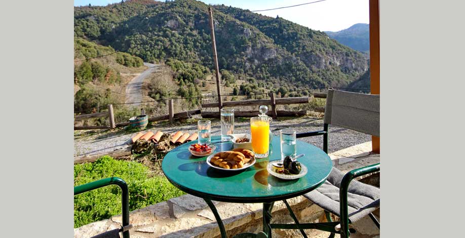
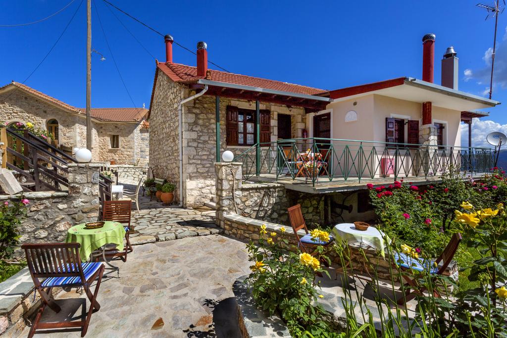
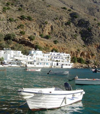
stemnitsa village on mountain menalon

Menalon Trail, in Greece

Level
3
Distance
80 km
Duration
8 days | 7 nights
period
Jan Feb Mar Apr May Jun Jul Aug Sep Oct
price from
€ 649
CO2 footprint
201 Kg/person
  1. Greece
  2.  | 
  3. Self-Guided
  4.  | 
  5. Tourcode GRSW036

The Menalon Trail is a 75 km long mountain trail that is qualified by the Leading Quality Trails-Best of Europe.

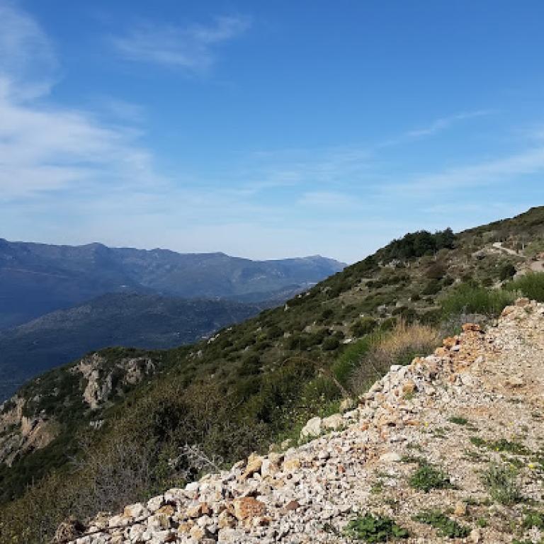
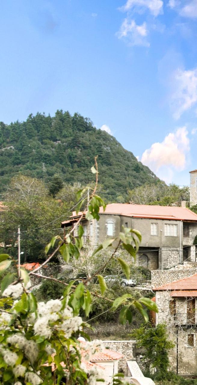
It begins in Stemnitsa, located in the heart of the Peloponnese. Through the lush Lousios Gorge the trail straddles the Western Menalon massif and runs through the Valley of the Mylaon River until the lively town of Vytina. It then continues through lush forests, across bridges and through pretty villages. 

Being awarded with the certificate, the trail is well-signposted and well-maintained. 

Through the dramatic Lousios gorge, with a handful of impressive monasteries built on its cliffs, you reach Dimitsana. Dense forests surround you on the stretch via Zygovisti, across the mountain pass Bilani to the remote village of Elati. This is followed by a short but great day along the Mylaon River to Vytina, famous for its Black Marble production.

The next day you wander slightly off the Menalon Trail, so as not to miss the pretty stone bridge which crosses over the Mylaon River. Back on the main trail, you continue to Nymfasia and stay overnight in small houses overlooking the area called Mavra Lithari: Black Stone.

read more >>
Highlights

  • Immerse yourself in a peaceful land of lush forests and timeless monasteries
  • Take pictures from the scenic Zarziou bridge
  • Visit the monasteries of Lousios gorge
  • Search for the mythological Arcadia, land of peace and harmony

Itinerary

Day 1

Arrival in Stemnitsa

Arrival in Stemnitsa

Arrival in Stemnitsa from Athens or Kalamata airport. You may visit the Menalon trail office in the central square of Stemnitsa for a briefing. Stemnitsa is traditionally the village of goldsmiths and still houses the Stemnitsa's Silver and Goldsmith School. There is also a nice folk museum.

Day 2

Through the Lousios gorge to Dimitsana, 13 km

Through the Lousios gorge to Dimitsana, 13 km

Departing from Stemnitsa the path zigzags down into the valley and via an old mule track you reach the Prodomos Monastery hanging on the high cliffs. After a visit you continue along the path that traverses the gorge. You may ascend to the Old Philosophou Monastery dating back to 963 before continuing to the New Philosophou Monastery that was founded in 1691.

Through lush vegetation you ascend via the left bank of the Lousios River towards Dimitsana. Via the Tzani bridge you go across the river and come to the very interesting Open Air Water Power Museum. Nearby you find watermills and gun powder mills, that made the fame and wealth of Dimitsana, a town built on the ruins of ancient Theftis.

Distance: 13 km

Elevation gain: +780/-910 m

Day 3

From Dimitsana to Elati, 19,5 km

From Dimitsana to Elati, 19,5 km

The section Dimitsana-Zygovisti ascends from the Lousios valley to the outskirts of the pine forest. The footpath ascends gently. From the church of St. Paraskevi you will enjoy splendid views of the median basin of Lousios river with the settlements of Dimitsana, Paliochori and Zatouna standing out in the wooded landscape. You continue via footpaths and dirt roads through old agricultural fields with remarkable threshing floors. Zygovisti played an important role in the Greek independence war of 1821. There is a big Memorial dedicated to the event. After a break at the local café the route continues and straddles the Western Menalon massif. First through a beautiful ravine to the country church of Agios Georgios and the adjacent spring. Then the track goes uphill through dense forests until the saddle from where you can optionally ascend the Pliovouni summit of 1643m, the highest peak of this route. After this demanding section, you descend via small roads and paths, passing fountains and chapels, to the mountain settlement of Elati.

Distance: 19,5 km

Elevation gain: +1215/-995 m

Day 4

From Elati to Vytina, 9 km

From Elati to Vytina, 9 km

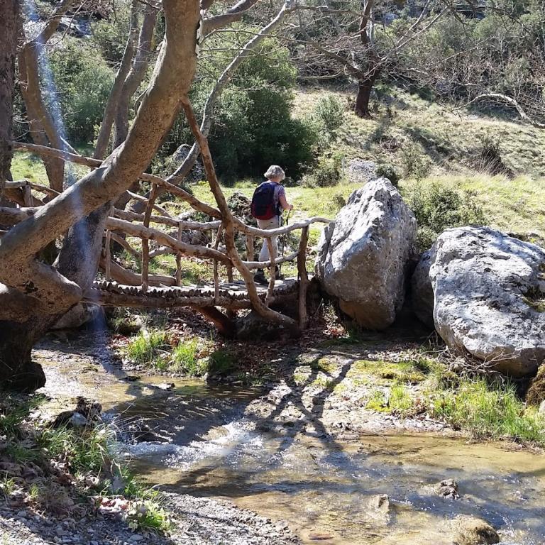
You may visit the woodcraft workshop before descending from Elati to the riverbed of the Mylaon River. You come past the Pirgaki Springs that supply Vytina with water and then the stone built Makrinou Fountain, a nice place for a short break. Further along the river the vegetation becomes even more rich with high plane trees.You walk past abandoned watermills and across a nice wooden bridge. Then you leave the valley and zigzag uphill via a path carved in rock to the Artotsi Fountain. Nearby is the Agia Paraskevi church from which you have great views over the valley and mountain. Via small roads you reach Vytina. Serving as the center village of the region, it offers all facilities and nice local food.

Distance: 9 km

Elevation gain: +350/-500 m

Day 5

From Vytina to Nymfasia via Zarziou bridge, 12 km

From Vytina to Nymfasia via Zarziou bridge, 12 km

From Vytina you head back to the Artotsi Fountain and descend via a zigzagging path into the valley of the Mylaon River. At the pretty wooden bridge, you now follow the river in northerly direction. In the area called Zarzi, you will see the very beautiful single-arch bridge of Zarzi with 2 relieving openings on the sides. The path takes you along past a peculiar shaped limestone pillar. Gradually you ascend and come to Old Vytina. Here you are back on the Menalon Trail that leads you to Mavra Litharia, a massive limestone boulder in the riverbed of the Mylaon River, thus creating an impressive gorge. You come to a second stone bridge that once secured the connection between Vytina and the western Gortynian villages. The trail descends to a short gorge before ascending gently through a rock-and-shrub landscape. Leading through oak and spruce forests, the trail descends to Nymfasia, a small village. You follow the route towards Kernitsas Monastery and just before the monastery head to your accommodation.

Distance: 12 km

Elevation gain: +630/-830 m

Day 6

From Nymfasia via Magouliana to Valtesiniko, 16 km

From Nymfasia via Magouliana to Valtesiniko, 16 km

You walk to the Kernitsa Bridge and ascend via a steep path to the Kernitsas Monastery, a big monastic complex surrounded by well-maintained terraced fields. After a visit you cross a dense pine forest and arrive at the Sfyrida Hermitage with a spring in front. Imagine how ascetes must have isolated themselves from the community in this mystic atmosphere. You traverse the foot of the long steep slope of Kastro. An old pathway leads you along the Gavros Spring. You enter the small settlement of Magouliana where you can find a tavern or café.

Leaving Magouliana behind, you come to a point with splendid views, surrounded by stone built threshing floors. You descend toward the old sanatorium, known as the Mana Sanatorium. A good path leads you in a gradual ascend to the nice village Valtesiniko. In the center of this village, well-known for its woodcarvers, there are many nice taverns to choose from for your evening meal.

Distance: 16 km

Elevation gain: +1200/-930 m

Day 7

From Valtesiniko to Lagkadia, 14,3 km

From Valtesiniko to Lagkadia, 14,3 km

From the upper peripheral road of Valtesiniko Village, we have splendid views over the northern plains. Via a cement road you walk up to 1250 meter. Via a footpath you walk along the ridge where the Byzantine Fortress of Valtesiniko is nested. Then you descend through open landscape with stunning views until the church of Agia Triada. The route now traverses an extensive pine forest and you gain some altitude before going down again until the Krya Vrysi fountain. You ascend the path to the saddle and then, finally, on the western edge of this zone, you will see Lagkadia ahead. Through fields and along a small spring you come to the outskirts of Lagkadia where the Rapi Watermills are situated. The Menalon Trail ends in the center of Lagkadia, the village of the stone builders.

Distance: 14,3 km

Elevation gain: +810/-980 m

Day 8

Goodbye Lagkadia!

Goodbye Lagkadia!

After breakfast your arrangement comes to an end. Travel to Athens or Kalamata Airport

Details

Is this for me?


An epic walk between the mountains of Peloponnese, gorges and Sanctuaries, with the greatest variety of flora and fauna in the Arcadia. This is the trip for you only if you have a good fitness level or have previous experience with long-distance hiking trips: expects continuous ups and downs, stone steps, challenging climbs and steep descents. Walking sticks are highly suggested! 

Included


What is included

  • 7 Nights in double room in *** hotels with breakfast
  • luggage transportation from hotel to hotel
  • 10 Euros contribution to the non-profit organization of the Menalon Trail
  • souvenir from the Menalon Trail
  • maps and detailed description of the itinerary
  • Medical and luggage travel insurance
  • 24h phone assistance

What is not included 

  • Transfers to the starting location and from the arriving location of the tour
  • lunches and dinners, if not otherwise stated
  • visits and entrance fees - tips
  • personal expense
  • possible sojourn taxes
  • everything that is not mentioned in the "What is included" section.

Optional Services

These services can be added to the ones included in the base price of the tour:

  • Single room supplement
  • cancellation insurance
  • Transfers to reach the starting location or to leave the arriving location of the tour, which will be quoted on request.

Accommodation


Para nuestros viajes, siempre seleccionamos alojamientos con habitaciones privadas y baños privados. En casos excepcionales, pueden incluirse alojamientos compartidos o baños compartidos, por lo que recomendamos revisar cuidadosamente la sección de inclusiones para comprender el tipo de alojamiento proporcionado en el viaje que le interese.

Damos gran importancia a la elección de los alojamientos y seleccionamos los hoteles con cuidado y atención. Sabemos lo esencial que es descansar bien después de un día de caminata. Preferimos alojamientos acogedores y con encanto, idealmente de gestión familiar, que realmente reflejen el espíritu del lugar y puedan recibirte con comodidad y calidez.

Cuando, debido a la naturaleza del recorrido, la elección de alojamientos es limitada, seleccionamos la opción que mejor se ajuste a nuestros estándares.

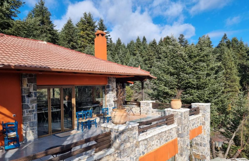
Stemnitsa – Tsarbou Guesthouse
Dimitsana – Proselinos Guesthouse
Elati – Home stay with Vana Anagnostou

In the tiny remote village Elati, you will stay in the private house of the family Anagnostou. Mrs. Vana will pamper you with traditional hospitality and make sure you will have a careless sleep after your walking day. She speaks English and this is an opportunity to get to know the local life in the Arcadian Mountains.

Vytina – Aiora Suites

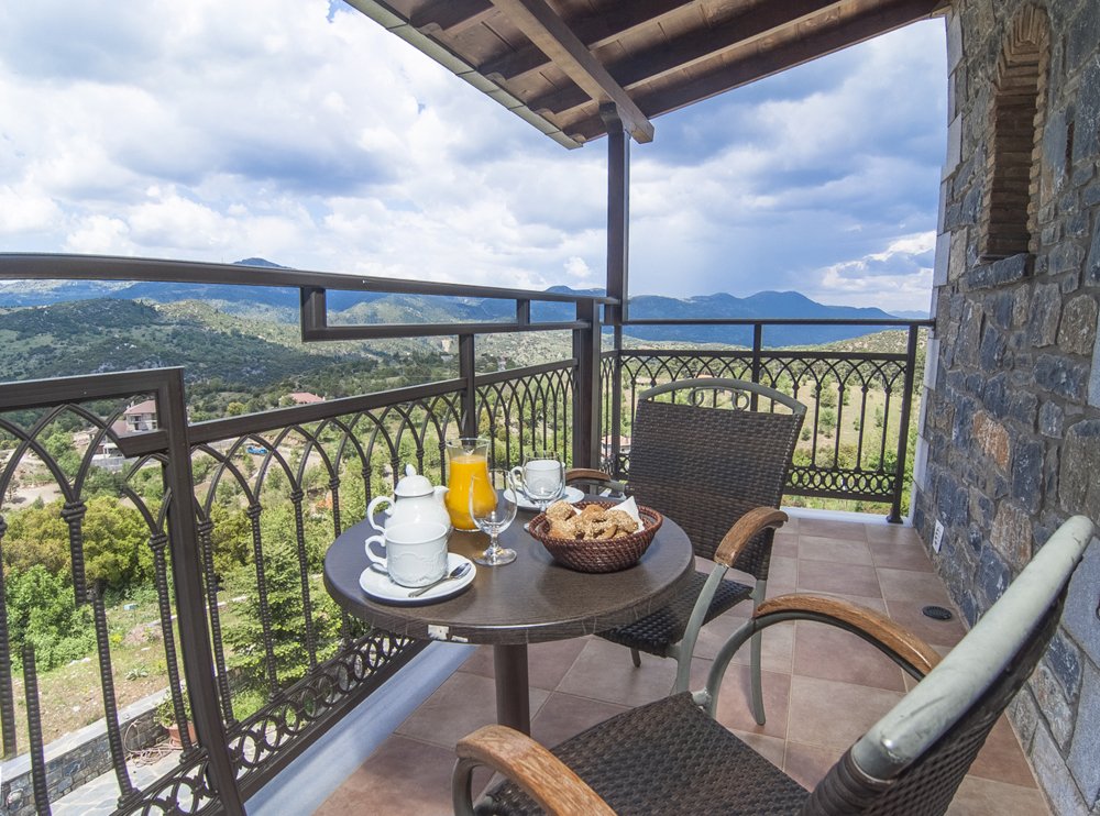
The small guesthouse offers 12 spacious rooms and a large public living room with beautiful fireplace and large windows offering panoramic views. The breakfast is excellent with many local delicacies and fresh products.

www.aiora-suites.gr

Nymfasia – Agropoli

The Agropoli gueshouse consists of 8 separate houses, each offering a one or two bedroom apartments. The breakfast is being served in the central building and is prepared by the family. The views from the complex are breathtaking and because it is located outside the village of Nymfasia, you really experience the peacefulness ot the countryside.

www.agropoli.gr

Valtesiniko – Valtesiniko Studios
Lagkadia – Kentrikon

Hotel Kentrikon belongs to the well-known Maniatis family in Lagkadia. The family runs a tavern as well. The hotel is built in modern style and offers smooth services and an extensive breakfast buffet. It is conveniently located in the center of the village near the central square and crafts shops.

www.maniatis-hotels.gr

When to travel


Start can be on any day of the week, year round. Because of the altitude of the trek (between 1000-1500m), the best spring period is after 20/04 until end of May. Also June, September and October are very suitable periods for this trip. July & August average temperature is 320 Celsius. It is also a great winter destination. Temperatures in December-February drop to 7 – 100 Celsius, with high chances of snow. Accommodations provide excellent facilities and have fire places. 

What to bring


Clothing and other items
You will need your regular walking/cycling gear, including some sort of reflective garment. For the evenings, smart outdoor style trousers (or shorts) are invaluable, as are quick-dry t-shirts. These can be washed easily and will dry overnight and still look good for sightseeing or having a drink in town.

Take as little as possible to avoid potentially lugging a heavy suitcase up three flights of stairs at the end of the day. Please be aware that laundromats (“Laverie”) are not common in rural areas, so plan to do handwashing of small items.

Lightweight walking shoes/ trainers
For wearing around towns & villages. They can also be a back-up pair.

Socks & underwear
Take only good quality socks with quick-dry and insulating qualities. Road test them before you go on the trip. Take a suitable quantity of underwear as washing facilities are limited.

Warm jacket, hat, gloves
Bring a fleece, Polartec or warm layers for the evenings especially in spring or autumn; be sure it is totally suitable for your needs.
A fleece jacket which blocks the wind (Wind-stopper) is the most preferable. In the summer months a lightweight jacket is suitable for evenings.
If you are cycling/walking in mountainous or coastal areas, even in the height of summer, the weather can change very quickly and unexpectedly and you should be prepared for fog, mist, rain, snow or hail at any time. Always take an extra layer with you, as well as a warm hat and gloves.

Waterproof jacket & trousers
If you are caught in heavy rain, with good waterproof clothing you should remain dry. Remember that most garments will lose their properties over time. Few will remain waterproof for more than five years and many deteriorate in three years or less. We recommend a rain jacket with a good hood and collar and waterproof or thermal walking/cycling trousers or tights.

Dress code
In general, you should wear suitable clothing when entering a church (in many places, it is considered unacceptable to go inside wearing shorts or a tank-top). We suggest that women carry a shawl to cover up bear shoulders or low-cut tops. It also comes in handy when your shoulders get sunburned!

It is considered inappropriate for men to go without a shirt / T-shirt (other than at the beach).

Trekking poles (adjustable)
Highly recommended. A pair works best, depending on what you are comfortable with. If you suffer from back or knee pain this should be considered essential. Remember to practise walking with your pole(s) on different types of terrain in the months preceding your trip.

Walking boots
The importance of good footwear cannot be stressed enough. Your boots should be sturdy and of good enough quality to handle all types of terrain. Lightweight boots, (cordura/leather boots) which have Gore-Tex or sympatex water-proofing are most suitable for this trip. They should provide good ankle protection and be well broken in. Waxing leather boots regularly prolongs their life.

Walking tops & trousers
We recommend walking trousers and shorts and quick-dry wicking t-shirts. These can be washed easily and will dry overnight and still look good for sightseeing or having a drink in town. Wicking T-shirts are fast drying, keep moisture away from your skin and are available at outdoor stores. You should also bring one pair of loose-fitting trousers to wear in cities and for evenings out, etc. Shorts or zip-off trousers are useful in warmer weather.

Practical info

Mobile App


The App has the detailed tracks and maps that you can use offline and without roaming. Thanks to the phone’s internal GPS, you can check your exact position on the map, so you always know exactly where you are. It also helps you self-navigate you way while travelling. More information on how to use the App inside the roadbook documents.

The navigation features include:

  • Offline navigation. Mobile data not required after initial download
  • Accurate GPS tracks
  • Autorotation of the maps
  • Daily route summary and elevation chart
  • Panorama of the track and at street level
  • Alarm and vibration that alerts you in case you go off track.
  • Emergency SMS button with position coordinates
  • Possibility to record and take georeferenced photos of problems on route alerting fellow travelers
  • Hotel information
  • Points of interest along the way
  • Historical background

You may also like:


Wanderlust Nominee Best Specialist Tour Operator 2023
Wanderlust
Nominee Best Specialist Tour Operator 2023
Change currency:

We accept:

VISA MASTERCARD

We accept:

VISA
MASTERCARD
FTO ATTA member
100% Green Travelife
ISO Partner
FTO ATTA member 100% Green Travelife ISO Partner

Touroperating
S-Cape Countryside Travels srl
Borgo Allegri 16R
50122 Firenze FI
P. IVA 05227330486

 
© 2025 SloWays. All rights reserved.
Touroperating S-Cape Countryside Travels srl Borgo Allegri 16R 50122 Firenze FI, Italy
VAT Nr 05227330486
extraSmallDevice
smallDevice
mediumDevice
largeDevice
largeDevice
largeDevice