Cammino di Oropa: Piedmont's Alpine pilgrimage

Level
2
Distance
62 km
Duration
4 days | 3 nights
period
Apr May Jun Jul Aug Sep Oct
price from
€ 455
CO2 footprint
31 Kg/person
  1. Italy
  2.  | 
  3. Self-Guided
  4.  | 
  5. Tourcode ITSM420

Discover a hidden gem in Piedmont - renowned as the home of the Slow Food movement - trekking along wooden paths that meander through pristine nature. 

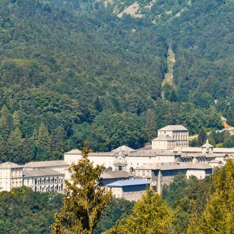
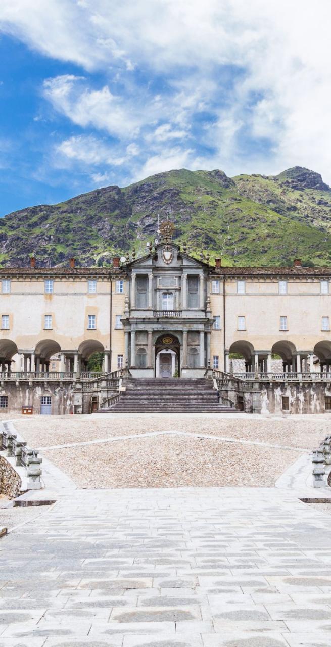
Embark on a brief yet enriching Camino, spanning just four days, from Santhià to the Oropa Sanctuary - a UNESCO world-heritage listed site and among the most important sanctuaries in Europe. The majestic dome of the Sanctuary will be your guide, visible throughout your journey. This route leads you from the spectacular Serra Morenica, Europe's most remarkable morainic amphitheater, to the jagged peaks of the Biellese Alps.

Each day unveils a distinct natural landscape: vast meadows, ancient 'ricetto' villages (fortified hamlets), and walled communities, culminating in the mystical aura of the Marian sanctuaries of Graglia and Oropa. 

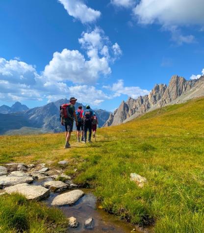
This shorter pilgrimage is very beginner-friendly with slow ascents through magnificent natural scenery starting from the Po Valley and heading steadily into the Piedmont’s Alps.

The majestic dome of the Sanctuary will be your guide, visible throughout your journey. This route leads you from the spectacular Serra Morenica, Europe's most remarkable morainic amphitheater, to the jagged peaks of the Biellese Alps.

Each day unveils a distinct natural landscape: vast meadows, ancient 'ricetto' villages (fortified hamlets), and walled communities, culminating in the mystical aura of the Marian sanctuaries of Graglia and Oropa, bastions of tranquility and awe.

This journey is perfectly suited for those looking to experience a walking trip for the first time, offering sufficient diversity to astonish even the seasoned travelers.

The Cammino di Oropa features a credential (Pilgrim Passport) and a Testimonium (a certificate of completion), marking your journey through this enchanting pathway.
Highlights

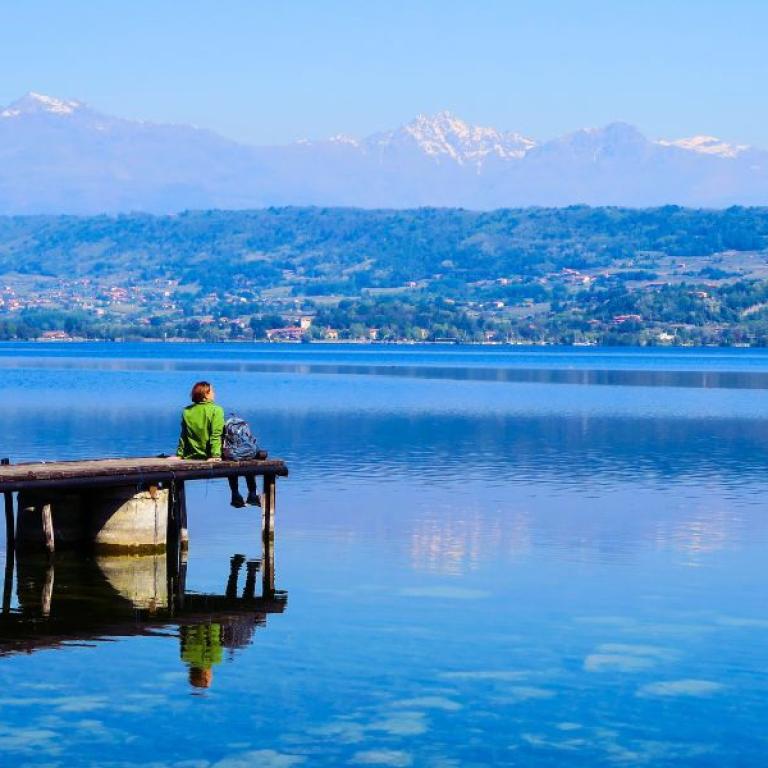
  • Admire the view over Viverone lake, from the hills around Roppolo
  • Discover the ancient ricetti, tiny fortified centres built in the middle age,
  • Feel the serenity of the Graglia Sanctuary

Itinerary

Day 1

From Santhia' to Roppolo, 15 Km

From Santhia' to Roppolo, 15 Km

Your adventure starts in Santhià, conveniently linked to Milan by train, where you initially tread upon a segment of the Via Francigena, Italy's most ancient pilgrimage path. As you progress, the trail guides you towards the morainic amphitheater of Ivrea. Along the way, consider pausing in Cavaglià to savor a "Bacio di dama" biscuit, flavored with rum, or the delightful canestrelli.

Today's journey concludes in Roppolo, dominated by its majestic castle. Wrap up your day with a visit to this fortress, which offers a breathtaking panorama over Viverone Lake. Should time allow, catch the sunset from this vantage point; it's a moment when the sky and lake blend in a stunning display of orange and pink hues, crafting a mesmerizing natural mosaic.

Distance: 15 km

Elevation gain: +200/-70 m

Day 2

From Roppolo to Sala Biellese, 16 km

From Roppolo to Sala Biellese, 16 km

Today's journey is a full-on nature immersion! After breakfast, you're off to the lush hills of the Serra d'Ivrea, Europe's most impressive morainic massif.

On your path, you'll discover a charming walled village: the ricetto of Viverone. It's a quaint collection of ancient homes, encircled by towers and walls, serving as a historical hideout for locals in times of threat. Plus, it offers yet another stunning viewpoint over the lake.

Your adventure continues as you ascend to the village of Zimone, perfect for a visit to the Bose Monastery, and then onto Magnano. Here, explore its ricetto and an old mill, an ideal spot to pick up some local treats and uncover the story of its ambitious founder. Your final stop today is Sala Biellese, where you can relax and reflect on the day’s explorations.

Distance: 16 km

Elevation gain: +400/-100 m

Day 3

From Sala Biellese to Santuario di Graglia, 15 km

From Sala Biellese to Santuario di Graglia, 15 km

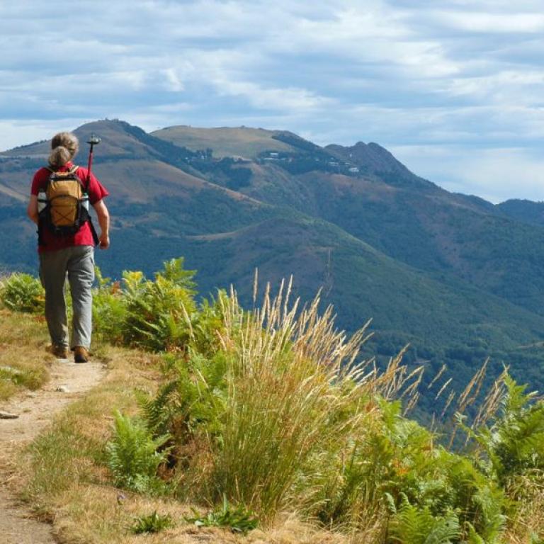
This walk leads you through the timeless forests of the Serra Morenica, dotted with expansive meadows and aged farmhouses along the way.

As you approach Donato, the vistas of the Biellese Alps grow increasingly captivating, presenting an endless horizon where snow-capped, pristine peaks rise majestically.

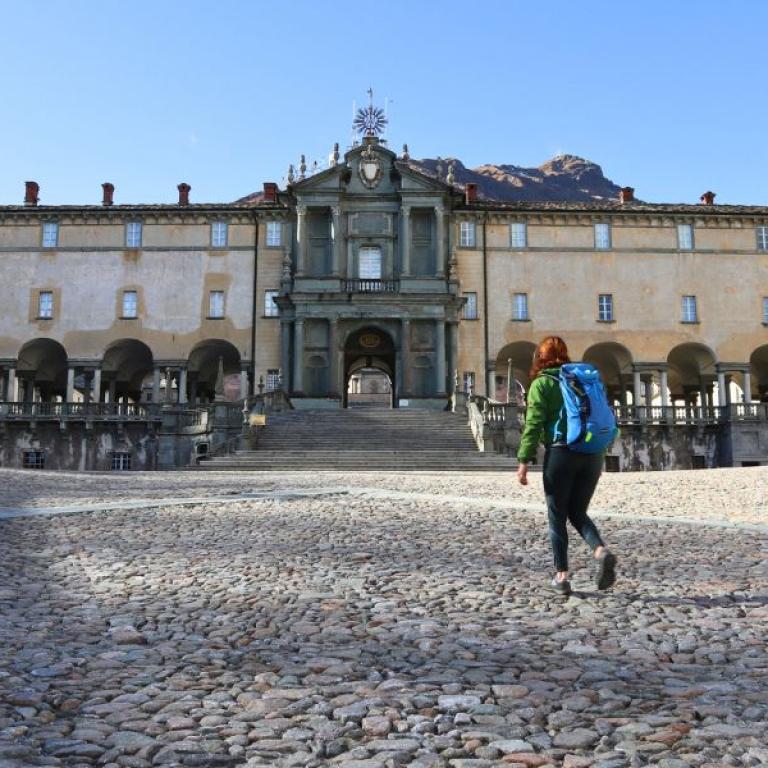
Today's destination is truly unique: the Sanctuary of Graglia, nestled at the base of Mombarone, straddling Piedmont and the Val d'Aosta. Recognized as one of Italy's most significant Marian worship sites, Graglia emanates a powerful energy, offering peace and serenity to all who visit.

Distance: 15 km

Elevation gain: +550/-320 m

Day 4

From Santuario di Graglia to Santuario di Oropa, 15 km

From Santuario di Graglia to Santuario di Oropa, 15 km

Today's route takes you along the slopes of the Mombardone mountain, offering a few mini-adventures like crossing shallow fords and climbing panoramic rises, before leading you into the charming historical heart of Sordevolo.

Though your final destination is near, the memorable sights are far from over: from Sordevolo to Favaro (where the last climb to the sanctuary begins), you'll wander through a continuous panorama of woodlands, pastures, and sweeping views over the Val Padana.

Your path then traces the old tramway that once connected Biella to the picturesque Oropa Sanctuary, marking the end of your journey. This sanctuary is not just your final stop but also one of the most revered Marian sanctuaries in the world.

Distance: 15 km

Elevation gain: +800/-470 m

Details

Is this for me?


This trip is perfect for both beginners and more experienced walkers: it's a surprising and fascinating and yet very approachable walk. The last stage includes a more challenging climb that can be skipped with public transportation. 

Included


What is included

  • 3 Nights in double room in **/*** hotels , B&B and camping with breakfast (breakfast not included in Graglia)
  • 1 dinner (in Sala Biellese)
  • luggage transportation from hotel to hotel and return transfer to Santhià
  • Travel documents in digital format, Navigation App
  • Pilgrim Passport
  • Medical and luggage travel insurance
  • 24h phone assistance

What is not included 

  • Transfers to the starting location and from the arriving location of the tour
  • lunches and dinners, if not otherwise stated
  • visits and entrance fees - tips
  • personal expense
  • possible sojourn taxes
  • everything that is not mentioned in the "What is included" section.

Optional Services

These services can be added to the ones included in the base price of the tour:

  • Single room supplement
  • cancellation insurance
  • Transfers to reach the starting location or to leave the arriving location of the tour, which will be quoted on request.

Accommodation


Para nuestros viajes, siempre seleccionamos alojamientos con habitaciones privadas y baños privados. En casos excepcionales, pueden incluirse alojamientos compartidos o baños compartidos, por lo que recomendamos revisar cuidadosamente la sección de inclusiones para comprender el tipo de alojamiento proporcionado en el viaje que le interese.

Damos gran importancia a la elección de los alojamientos y seleccionamos los hoteles con cuidado y atención. Sabemos lo esencial que es descansar bien después de un día de caminata. Preferimos alojamientos acogedores y con encanto, idealmente de gestión familiar, que realmente reflejen el espíritu del lugar y puedan recibirte con comodidad y calidez.

Cuando, debido a la naturaleza del recorrido, la elección de alojamientos es limitada, seleccionamos la opción que mejor se ajuste a nuestros estándares.

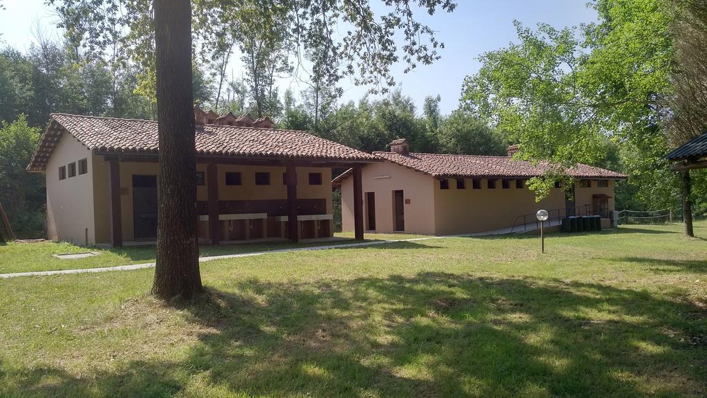
B&B Le Lune - Roppolo
Camping Future is Nature - Sala Biellese
Santuario di Graglia - Graglia

When to travel


The climate in Northern Italy is generally very mild with differences depending on the geography of the region, from coasts and valleys to the continental areas.The warmest months are generally July and August, with temperatures ranging from 23°C up to 30°C; the valleys can often see higher  temperatures and 38°C to 40°C is not uncommon. While June and September offer both nice warm weather. Of course, there are always exceptions or dry spells that cause a few days to get really hot.Spring (April and May) and Autumn (October and November) are dry, with sunny days but the chances of rain are high.The weather can change very quickly and you must be prepared forrain, mist, wind, fog (and even hail or snow at higher elevations) –especially in spring and autumn. 

What to bring


Clothing and other items
You will need your regular walking/cycling gear, including some sort of reflective garment. For the evenings, smart outdoor style trousers (or shorts) are invaluable, as are quick-dry t-shirts. These can be washed easily and will dry overnight and still look good for sightseeing or having a drink in town.

Take as little as possible to avoid potentially lugging a heavy suitcase up three flights of stairs at the end of the day. Please be aware that laundromats (“Laverie”) are not common in rural areas, so plan to do handwashing of small items.

Lightweight walking shoes/ trainers
For wearing around towns & villages. They can also be a back-up pair.

Socks & underwear
Take only good quality socks with quick-dry and insulating qualities. Road test them before you go on the trip. Take a suitable quantity of underwear as washing facilities are limited.

Warm jacket, hat, gloves
Bring a fleece, Polartec or warm layers for the evenings especially in spring or autumn; be sure it is totally suitable for your needs.
A fleece jacket which blocks the wind (Wind-stopper) is the most preferable. In the summer months a lightweight jacket is suitable for evenings.
If you are cycling/walking in mountainous or coastal areas, even in the height of summer, the weather can change very quickly and unexpectedly and you should be prepared for fog, mist, rain, snow or hail at any time. Always take an extra layer with you, as well as a warm hat and gloves.

Waterproof jacket & trousers
If you are caught in heavy rain, with good waterproof clothing you should remain dry. Remember that most garments will lose their properties over time. Few will remain waterproof for more than five years and many deteriorate in three years or less. We recommend a rain jacket with a good hood and collar and waterproof or thermal walking/cycling trousers or tights.

Dress code
In general, you should wear suitable clothing when entering a church (in many places, it is considered unacceptable to go inside wearing shorts or a tank-top). We suggest that women carry a shawl to cover up bear shoulders or low-cut tops. It also comes in handy when your shoulders get sunburned!

It is considered inappropriate for men to go without a shirt / T-shirt (other than at the beach).

Trekking poles (adjustable)
Highly recommended. A pair works best, depending on what you are comfortable with. If you suffer from back or knee pain this should be considered essential. Remember to practise walking with your pole(s) on different types of terrain in the months preceding your trip.

Walking boots
The importance of good footwear cannot be stressed enough. Your boots should be sturdy and of good enough quality to handle all types of terrain. Lightweight boots, (cordura/leather boots) which have Gore-Tex or sympatex water-proofing are most suitable for this trip. They should provide good ankle protection and be well broken in. Waxing leather boots regularly prolongs their life.

Walking tops & trousers
We recommend walking trousers and shorts and quick-dry wicking t-shirts. These can be washed easily and will dry overnight and still look good for sightseeing or having a drink in town. Wicking T-shirts are fast drying, keep moisture away from your skin and are available at outdoor stores. You should also bring one pair of loose-fitting trousers to wear in cities and for evenings out, etc. Shorts or zip-off trousers are useful in warmer weather.

Practical info

How to arrive


On both arrival and departure, the train station to travel to and from is Santhià, as the package includes a private transfer back to Santhià on the last day.

Mobile App


Use the SloWays APP for iOS and Android smart phones in combination with the written documentation provided.

The App has the detailed tracks and maps that you can use offline and without roaming. Thanks to the phone’s internal GPS, you can check your exact position on the map, so you always know exactly where you are. It also helps you self-navigate you way while travelling. More information on how to use the App inside the roadbook documents.

The navigation features include:

  • Offline navigation. Mobile data not required after initial download
  • Accurate GPS tracks
  • Autorotation of the maps
  • Daily route summary and elevation chart
  • Panorama of the track and at street level
  • Alarm and vibration that alerts you in case you go off track.
  • Emergency SMS button with position coordinates
  • Possibility to record and take georeferenced photos of problems on route alerting fellow travelers
  • Hotel information
  • Points of interest along the way
  • Historical background

You may also like:


Wanderlust Nominee Best Specialist Tour Operator 2023
Wanderlust
Nominee Best Specialist Tour Operator 2023
Change currency:

We accept:

VISA MASTERCARD

We accept:

VISA
MASTERCARD
FTO ATTA member
100% Green Travelife
ISO Partner
FTO ATTA member 100% Green Travelife ISO Partner

Touroperating
S-Cape Countryside Travels srl
Borgo Allegri 16R
50122 Firenze FI
P. IVA 05227330486

 
© 2025 SloWays. All rights reserved.
Touroperating S-Cape Countryside Travels srl Borgo Allegri 16R 50122 Firenze FI, Italy
VAT Nr 05227330486
extraSmallDevice
smallDevice
mediumDevice
largeDevice
largeDevice
largeDevice