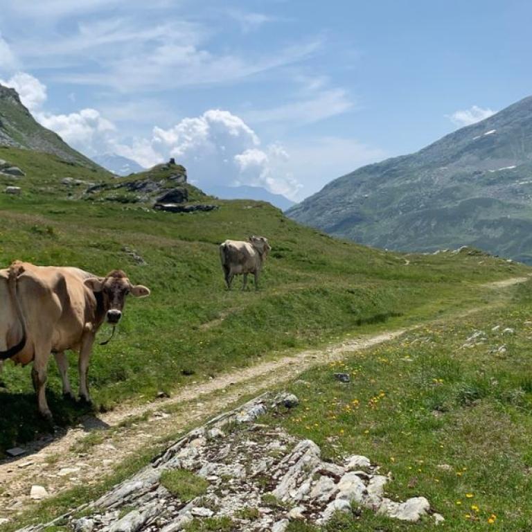
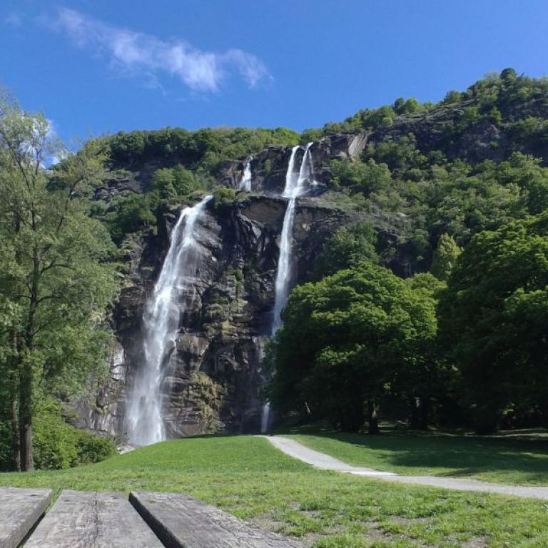
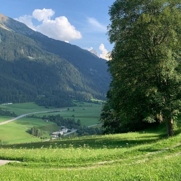
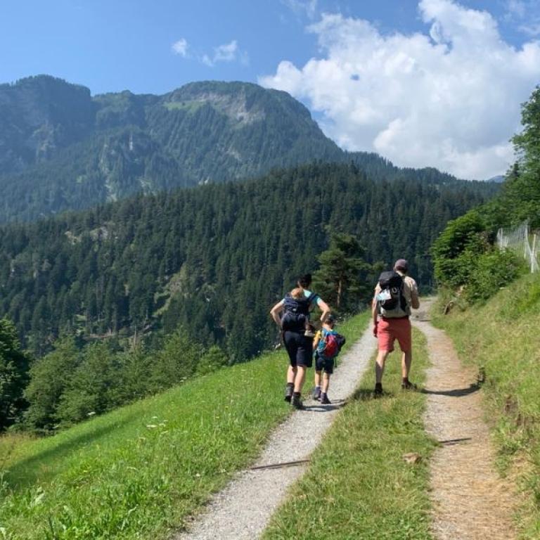
the high mountains and green meadows of the via spluga

Via Spluga: Switzerland to Northern Italy

Level
2
Distance
67 km
Duration
6 days | 5 nights
period
Jun Jul Aug Sep
price from
€ 1.045
CO2 footprint
104 Kg/person
  1. Italy
  2.  | 
  3. Self-Guided
  4.  | 
  5. Tourcode ITSW510

The via Spluga represents a classic cultural hiking route within the central Alps which, throughout the centuries, has linked the towns of Thusis (Switzerland) and Chiavenna (Italy), hence incorporating the Grigionese people, the Rhaeto-Romansch, Walser and the population of Lombardia. Most of the routes winds its way gently along old mule-tracks which have either maintained their original characteristics or have at least been restored to something like their natural state.

The walk, as well as offering the opportunity to appreciate a slice of genuine history also permits you to get to know a very particular mountain terrain alongside the local population whose life has been particularly influenced by generations of travellers making their way across the Alpine pass. It ends in Chiavenna, a beautiful mountain town not too far from Lake Como - this enchanting village is famous for the cuisine of Crotti and the beauty of its historical center. 

Highlights

  • Discover the mountain trails along the Via Spluga
  • Experience the rich culture
  • Chiavenna, a beautiful town with fabulous views of the mountains
  • The ancient and well-maintained mule track paths
  • The Piuro waterfalls 

Itinerary

Day 1

Arrival in Splugen

Arrival in Splugen
In the entire Alpine region it´s difficult to imagine a settlement so characterised and indelibly marked by the unmistakeable signs of movement towards and over mountain passes. Thanks to considerable efforts it´s been made possible for visitors to appreciate fully the lingering image that Splügen displays in all its original splendour. Even today it´s not difficult to understand two very different aspects of this crossroads: the elegant, stylish mansions typical of the Spluga Pass, which occupy the outskirts of Sustenbach and other houses in Walser style of the "Bsetzi", the part of the town to the west of the historic centre with its typical network of cobbled alleys. The local museum - Rheinwalder Heimatmuseum - is well worth a visit, where the history of centuries of transit through the valley is splendidly documented.

Day 2

From Splügen to Montespluga, 10 km

From Splügen to Montespluga, 10 km

Before heading off again it’s certainly worth having a look at Splügen village itself, an impressive example of meticulous conservation. Alpine pastures with breathtaking panorama of the surrounding peaks, avalanche barrier tunnels and well-maintained, cobbled/paved mule-tracks are all set to feature along this high-altitude and expansive section, enhanced by the heady fragrance of blooms as we move up from the village on the northern slope of the Pass prior to the descent on the Italian side to the village of Montespluga, where you can breathe in the atmosphere of times past.

Distance: 10 km

Elevation gain: +660/-250 m

Day 3

From Montespluga to Isola di Chiavenna, 9 km

From Montespluga to Isola di Chiavenna, 9 km

From the village of Montespluga the route takes on the right side of the reservoir in order to reach one of the two dams and to appreciate some spectacular views over the Cardinello Gorge: this is one of the most dramatic sections guaranteed to linger long in the memory.

It’s a route which was not created without considerable exertions over the years, with the imposing rock faces to the left and up above and

the steep gorge plunging away to the right where the torrent itself courses. The descent requires a certain amount of caution but it’s not demanding and leads us gently towards the typical wooden mountain dwellings (baite) of Sosta, Mottaletta and finally to Isola.

Distance: 9 km

Elevation gain: +130/-770 m

Day 4

From Isola di Chiavenna to Campodolcino and bus to Chiavenna, 6 km

From Isola di Chiavenna to Campodolcino and bus to Chiavenna, 6 km

A section which is practically all downhill in nature, following the route of the Liro torrent and introducing the hiker to the joys of Val San Giacomo: we’re wandering along pathways between well-tended dry-stone wall and meadow, through chestnut groves and taking in places of considerable historical and religious interest.

From Campodolcino take the local bus to Chiavenna. Full of corners, narrow lanes and aging stone walls, Chiavenna is a beguiling spot, no matter how many times you meander through its charming historic centre. Be sure to cross the ancient bridge over the Mera and enjoy the storybook views of the town.

Distance: 6 km

Elevation gain: +85/-230 m

Day 5

Bus to Campodolcino and walk to Chiavenna, 13 km

Bus to Campodolcino and walk to Chiavenna, 13 km

In the morning a short bus ride will take you from Chiavenna to Campodolcino. We approach Chiavenna along a path with magnificent panorama over the length of Valchiavenna; from the age- old terraces hosting traditional vineyards you catch your first glimpse of a very special Alpine community, with its immaculately preserved historic centre.

Distance: 13 km

Elevation gain: +230/-1005 m

Day 6

Departure from Chiavenna

Departure from Chiavenna
The trip and our services end after breakfast and you bid farewell to the beautiful lakes as you depart for the airport with public transport, unless you have pre-booked a private transfer with us.

Details

Is this for me?


A journey through the mountains on the border between Italy and Switzerland that concludes in Chiavenna, a beautiful town north of Lake Como.

This trip is suitable for those with prior experience in mountain travel: the altitudes - both uphill and downhill - can be quite challenging in some cases, requiring trained legs and sure-footedness. The terrain is at times unstable, and you'll walk on paths where it's important to watch out for protruding roots or stones that could hinder your progress. For this reason, it's not recommended for those without a particular sense of stability or prior experience in mountain travel.

Included


What is included

  • 5 Nights in double room in **/*** hotels , B&B with breakfast
  • luggage transportation from hotel to hotel
  • 2 dinners (Montespluga, Isola)
  • maps and detailed description of the itinerary in digital form, app
  • Medical and luggage travel insurance
  • 24h phone assistance

What is not included 

  • Transfers to the starting location and from the arriving location of the tour
  • lunches and dinners, if not otherwise stated
  • visits and entrance fees - tips
  • personal expense
  • possible sojourn taxes
  • everything that is not mentioned in the "What is included" section.

Optional Services

These services can be added to the ones included in the base price of the tour:

  • Single room supplement
  • cancellation insurance
  • Transfers to reach the starting location or to leave the arriving location of the tour, which will be quoted on request.
  • travel documentation in printed form (maps and detailed description of the itinerary), shipped to the first hotel

Accommodation


For our trips, we always select accommodations with private rooms and private bathrooms. In rare cases, shared accommodations or shared bathrooms may be included, so we recommend carefully checking the inclusions section to understand the type of accommodation provided for the trip you’re interested in.

We place great importance on the choice of lodging and select hotels with care and attention. We know how essential it is to rest well after a day of walking. We prefer welcoming and charming accommodations, ideally family-run, that truly embody the spirit of the place and can welcome you with comfort and warmth.

Where, due to the nature of the route, the choice of accommodations is limited, we select the option that best aligns with our standards.

Weiss Kreuz - Spluga

www.weiss-kreuz.ch

Albergo Vittoria - Montespluga
Locanda Cardinello - Isola di Chiavenna
Hotel San Lorenzo - Chiavenna

What to bring


Clothing and other items
You will need your regular walking/cycling gear, including some sort of reflective garment. For the evenings, smart outdoor style trousers (or shorts) are invaluable, as are quick-dry t-shirts. These can be washed easily and will dry overnight and still look good for sightseeing or having a drink in town.

Take as little as possible to avoid potentially lugging a heavy suitcase up three flights of stairs at the end of the day. Please be aware that laundromats (“Laverie”) are not common in rural areas, so plan to do handwashing of small items.

Lightweight walking shoes/ trainers
For wearing around towns & villages. They can also be a back-up pair.

Socks & underwear
Take only good quality socks with quick-dry and insulating qualities. Road test them before you go on the trip. Take a suitable quantity of underwear as washing facilities are limited.

Warm jacket, hat, gloves
Bring a fleece, Polartec or warm layers for the evenings especially in spring or autumn; be sure it is totally suitable for your needs.
A fleece jacket which blocks the wind (Wind-stopper) is the most preferable. In the summer months a lightweight jacket is suitable for evenings.
If you are cycling/walking in mountainous or coastal areas, even in the height of summer, the weather can change very quickly and unexpectedly and you should be prepared for fog, mist, rain, snow or hail at any time. Always take an extra layer with you, as well as a warm hat and gloves.

Waterproof jacket & trousers
If you are caught in heavy rain, with good waterproof clothing you should remain dry. Remember that most garments will lose their properties over time. Few will remain waterproof for more than five years and many deteriorate in three years or less. We recommend a rain jacket with a good hood and collar and waterproof or thermal walking/cycling trousers or tights.

Dress code
In general, you should wear suitable clothing when entering a church (in many places, it is considered unacceptable to go inside wearing shorts or a tank-top). We suggest that women carry a shawl to cover up bear shoulders or low-cut tops. It also comes in handy when your shoulders get sunburned!

It is considered inappropriate for men to go without a shirt / T-shirt (other than at the beach).

Trekking poles (adjustable)
Highly recommended. A pair works best, depending on what you are comfortable with. If you suffer from back or knee pain this should be considered essential. Remember to practise walking with your pole(s) on different types of terrain in the months preceding your trip.

Walking boots
The importance of good footwear cannot be stressed enough. Your boots should be sturdy and of good enough quality to handle all types of terrain. Lightweight boots, (cordura/leather boots) which have Gore-Tex or sympatex water-proofing are most suitable for this trip. They should provide good ankle protection and be well broken in. Waxing leather boots regularly prolongs their life.

Walking tops & trousers
We recommend walking trousers and shorts and quick-dry wicking t-shirts. These can be washed easily and will dry overnight and still look good for sightseeing or having a drink in town. Wicking T-shirts are fast drying, keep moisture away from your skin and are available at outdoor stores. You should also bring one pair of loose-fitting trousers to wear in cities and for evenings out, etc. Shorts or zip-off trousers are useful in warmer weather.

Practical info

How to arrive


On Arrival:

From Switzerland:

  • The closest airport is Zurich.
  • From Zurich you can reach Thusis by train, check timetable online at: www.sbb.ch/en/.
  • From Thusis there are direct buses running to Splügen, check timetable online at www.postauto.ch/en.

From Italy:

  • From any Italian airport, take the local bus or train to Milano Centrale.
  • From Milano Centrale you can reach Chiavenna by train, check timetables online at www.trenitalia.com/en.
  • From Chiavenna  take the local bus, check timetables online at www.stps.it/

On Departure:

From Chiavenna train station you can reach any Italian airport.

Mobile App


Use the SloWays APP for iOS and Android smart phones in combination with the written documentation provided.

The App has the detailed tracks and maps that you can use offline and without roaming. Thanks to the phone’s internal GPS, you can check your exact position on the map, so you always know exactly where you are. It also helps you self-navigate you way while travelling. More information on how to use the App inside the roadbook documents.

The navigation features include:

  • Offline navigation. Mobile data not required after initial download
  • Accurate GPS tracks
  • Autorotation of the maps
  • Daily route summary and elevation chart
  • Panorama of the track and at street level
  • Alarm and vibration that alerts you in case you go off track.
  • Emergency SMS button with position coordinates
  • Possibility to record and take georeferenced photos of problems on route alerting fellow travelers
  • Hotel information
  • Points of interest along the way
  • Historical background

Wanderlust Nominee Best Specialist Tour Operator 2023
Wanderlust
Nominee Best Specialist Tour Operator 2023
Change currency:

We accept:

VISA MASTERCARD

We accept:

VISA
MASTERCARD
FTO ATTA member
100% Green Travelife
FTO ATTA member 100% Green Travelife

Touroperating
S-Cape Countryside Travels srl
Borgo Allegri 16R
50122 Firenze FI
P. IVA 05227330486

 
© 2024 SloWays. All rights reserved.
Touroperating S-Cape Countryside Travels srl Borgo Allegri 16R 50122 Firenze FI, Italy
VAT Nr 05227330486
extraSmallDevice
smallDevice
mediumDevice
largeDevice
largeDevice
largeDevice